West Valley, San Jose
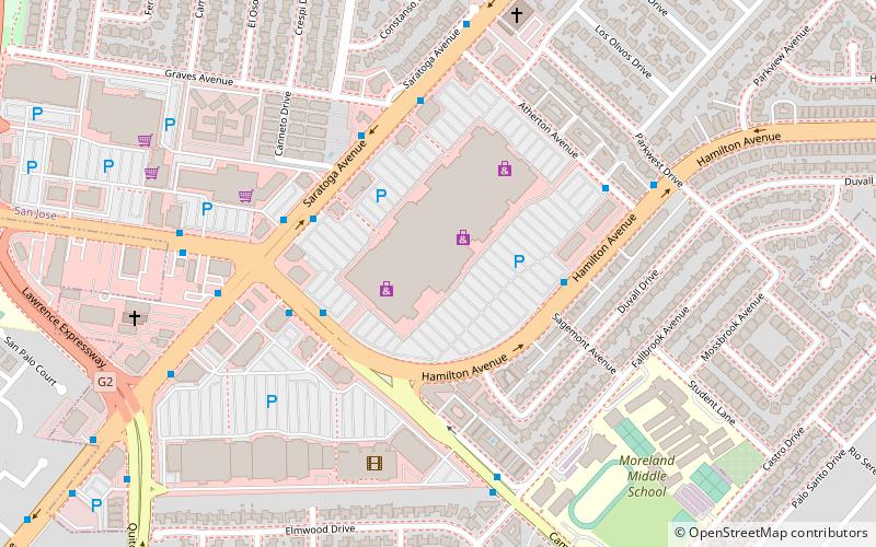
Map
Facts and practical information
The West Valley is a region of Santa Clara Valley in the San Francisco Bay Area. Making up the western portion of Santa Clara County, the West Valley includes the West San Jose neighborhood of the city of San Jose, along with the cities of Campbell, Cupertino, Los Gatos, Monte Sereno, and Saratoga. The West Valley is home to several notable high-tech Silicon Valley headquarters, such as Apple in Cupertino and Netflix in Los Gatos. ()
Coordinates: 37°17'29"N, 121°59'19"W
Address
West Valley (Hathaway)San Jose
ContactAdd
Social media
Add
Getting there by public transportation
Public transportation stops near this location
- Bus
 Bus
Bus
- Calculate routeWest Hamilton Avenue & Sagemont Avenue 4 min walk
- Calculate routeSaratoga Avenue & West Campbell Avenue 4 min walk
- Calculate routeWest Campbell Avenue & Saratoga Avenue 4 min walk
Day trips


Frequently Asked Questions (FAQ)
How to get to West Valley by public transport?
The nearest stations to West Valley:
Bus
Bus
- West Hamilton Avenue & Sagemont Avenue • Lines: 56 (4 min walk)
- Saratoga Avenue & West Campbell Avenue • Lines: 56, 57 (4 min walk)