Southeast Side, Chicago
Map
Facts and practical information
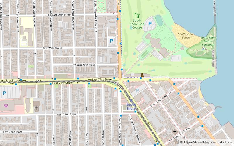
The Southeast side of Chicago officially begins East of State Street going southwards. It extends south and east to the city limits, generally keeping between Lake Michigan and Lake Calumet. Politically, the Southeast side is contiguous with the 10th Ward. ()
Coordinates: 41°45'60"N, 87°33'60"W
Address
South Side (South Shore)Chicago
ContactAdd
Social media
Add
Getting there by public transportation
Public transportation stops near this location
- Bus
- Train
 Bus
Bus
- Calculate routeSouth Shore Drive & 71st Street 1 min walk
- Calculate route71st Street & Yates 2 min walk
- Calculate routeYates & Exchange 2 min walk
- Calculate routeSouth Shore 3 min walk
- Calculate routeBryn Mawr 15 min walk
- Calculate routeWindsor Park 18 min walk
- Calculate routeStony Island 28 min walk
Maps Rail "L"
Rail "L"Day trips


Frequently Asked Questions (FAQ)
Which popular attractions are close to Southeast Side?
Nearby attractions include South Shore Cultural Center, Chicago (6 min walk), South Shore, Chicago (11 min walk), Shoreline Apartments, Chicago (13 min walk), Jeffery Theater, Chicago (13 min walk).
How to get to Southeast Side by public transport?
The nearest stations to Southeast Side:
Bus
Train
Bus
- South Shore Drive & 71st Street • Lines: 26, 6 (1 min walk)
- 71st Street & Yates • Lines: 71 (2 min walk)
Train
- South Shore (3 min walk)
- Bryn Mawr (15 min walk)