Flint Local 432, Flint
Map
Facts and practical information
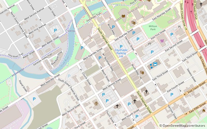
The Flint Local 432 is a non-profit 501, all-ages, substance free music venue located in downtown Flint, Michigan. The Local's name is a reference to the autoworker unions located in the area. It was founded in the mid-1980s by Joel Rash, for the purpose of providing the Flint area with an all-ages venue for local and national bands to play that was focused on the music. Even though it has faced many challenges and changed buildings multiple times, the Local has continued to survive to the current day and been a home to any band that wants to be heard. ()
Coordinates: 43°0'56"N, 83°41'31"W
Address
Downtown FlintFlint
ContactAdd
Social media
Add
Getting there by public transportation
Public transportation stops near this location
- Bus
 Bus
Bus
- Calculate route14 5 min walk
- Calculate route12 6 min walk
- Calculate route2 6 min walk
- Calculate route11 6 min walk
Day trips


Frequently Asked Questions (FAQ)
Which popular attractions are close to Flint Local 432?
Nearby attractions include First Street Lofts, Flint (2 min walk), Charles Stewart Mott Foundation Building, Flint (3 min walk), Flint Journal Building, Flint (5 min walk), Capitol Theatre Building, Flint (5 min walk).
How to get to Flint Local 432 by public transport?
The nearest stations to Flint Local 432:
Bus
Bus
- 14 • Lines: 12 (5 min walk)
- 12 • Lines: 10 (6 min walk)