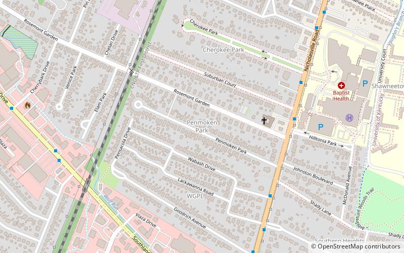
Penmoken Park, Lexington
Map
Facts and practical information
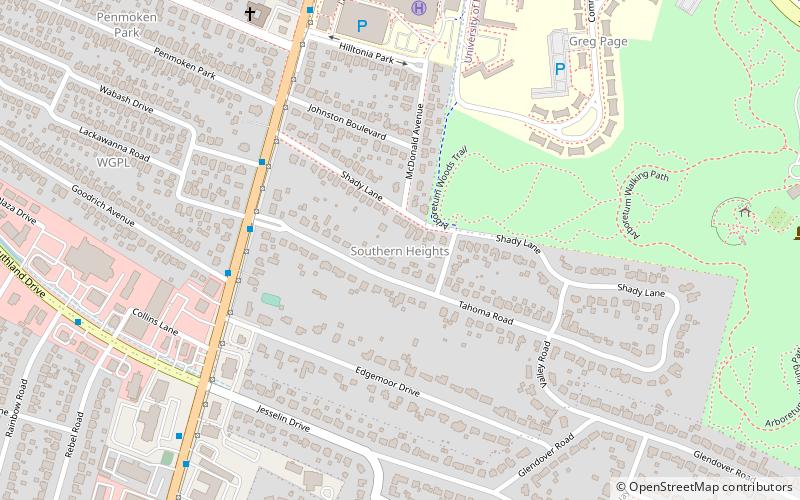
Penmoken Park is a neighborhood in southwestern Lexington, Kentucky, United States. It is composed of a single street - Penmoken Park. It is bounded by Rosemont Garden to the north, Nicholasville Road to the east, and the Norfolk Southern railroad tracks to the west. ()
Coordinates: 38°1'2"N, 84°31'6"W
Address
Wabash-GoodrichLexington
ContactAdd
Social media
Add
Getting there by public transportation
Public transportation stops near this location
- Bus
 Bus
Bus
- Calculate route1370 - Nicholasville @ Wabash Outbound 6 min walk
- Calculate route1369 - Nicholasville @ 1721 Outbound 7 min walk
- Calculate route1385 - Nicholasville @ Tahoma Inbound 8 min walk
- Calculate route1371 - Nicholasville @ Goodrich Outbound 8 min walk
Day trips
Penmoken Park – popular in the area (distance from the attraction)
Nearby attractions include: Cliff Hagan Stadium, University of Kentucky Arboretum, Nannine Clay Wallis Arboretum, Thoroughbred Heritage Horse Farm Tours.


Frequently Asked Questions (FAQ)
Which popular attractions are close to Penmoken Park?
Nearby attractions include Seven Parks, Lexington (11 min walk), Southern Heights, Lexington (11 min walk), Oleika Shrine Temple, Lexington (11 min walk), Hill N Dale, Lexington (16 min walk).
How to get to Penmoken Park by public transport?
The nearest stations to Penmoken Park:
Bus
Bus
- 1370 - Nicholasville @ Wabash Outbound • Lines: 16 Southland Dr, 5, 5 Nicholasville Road (6 min walk)
- 1369 - Nicholasville @ 1721 Outbound • Lines: 16 Southland Dr, 5, 5 Nicholasville Road (7 min walk)