Newark Riverfront Park, Newark
Facts and practical information
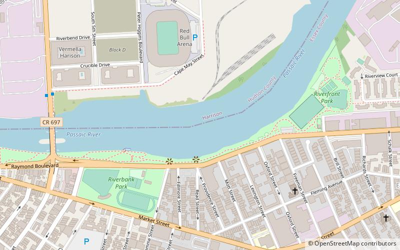
Newark Riverfront Park is a park and promenade being developed in phases along the Passaic River in Newark, New Jersey, United States. The park, expected to be 3 miles long and encompass 30.5 acres, is being created from brownfield sites along the river, which itself is a Superfund site due to decades of pollution. It will follow the river between the Ironbound section along Raymond Boulevard and Downtown Newark along McCarter Highway. Announced in 1999, a groundbreaking took place in 2008, and the first phase of the park opened in 2012. It was the first time residents of the largest city in New Jersey have ever had public access to the river. Other segments of the park have subsequently opened, while others are being developed. The East Coast Greenway uses paths and roads along the park. ()
HarrisonNewark
- Metro
- Bus
- Light rail
- Train
 Metro
Metro
- Calculate routeHarrison 14 min walk
- Calculate routeNewark Penn Station 20 min walk
- Calculate routeNewark Penn Station 20 min walk
- Calculate routeNewark Penn Bus Terminal 20 min walk
- Calculate routeNewark Penn Station 20 min walk
- Calculate routeNJPAC/Center Street 25 min walk
- Calculate routeMilitary Park 31 min walk
- Calculate routeAtlantic Street 32 min walk
- Calculate routeNewark Penn Station 21 min walk


Frequently Asked Questions (FAQ)
Which popular attractions are close to Newark Riverfront Park?
How to get to Newark Riverfront Park by public transport?
Metro
- Harrison • Lines: Nwk–Wtc (14 min walk)
- Newark Penn Station • Lines: Nwk–Wtc (20 min walk)
Bus
- Newark Penn Station • Lines: 62 (20 min walk)
- Newark Penn Bus Terminal (20 min walk)
Light rail
- Newark Penn Station • Lines: Nlr (20 min walk)
- NJPAC/Center Street • Lines: Nlr (25 min walk)
Train
- Newark Penn Station (21 min walk)