East Durham Historic District, Durham
Map
Facts and practical information
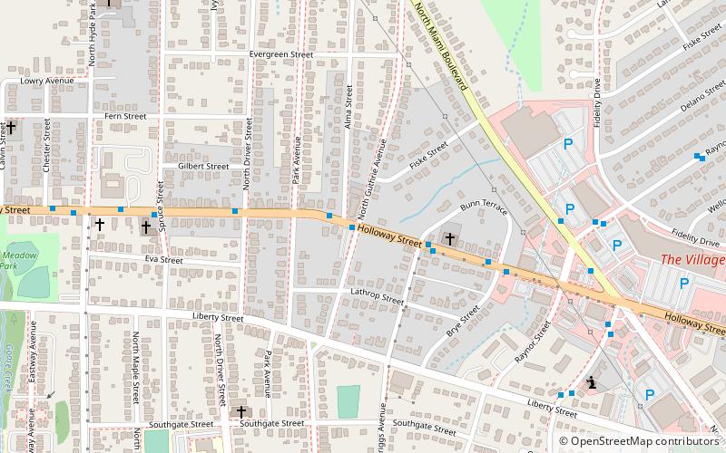
East Durham Historic District is a national historic district located at Durham, Durham County, North Carolina. The district encompasses 731 contributing buildings and 1 contributing site in a predominantly residential section of Durham. The buildings primarily date between about 1890 and 1955 and include notable examples of Classical Revival and Queen Anne architecture. Notable buildings include the Holloway Street School, East Durham Junior High School, Advent Christian Church, John Cheek House, Community Groceries, George Brown Grocery Store, Seagroves Grocery Store, and The People's Bank. ()
Area: 226 acres (0.3531 mi²)Coordinates: 35°59'39"N, 78°52'31"W
Address
Northeast Central DurhamDurham
ContactAdd
Social media
Add
Getting there by public transportation
Public transportation stops near this location
- Bus
 Bus
Bus
- Calculate routeRaynor St at The Village 8 min walk
- Calculate routeAngier Ave at Guthrie Ave 23 min walk
Day trips


Frequently Asked Questions (FAQ)
Which popular attractions are close to East Durham Historic District?
Nearby attractions include West Durham Historic District, Durham (1 min walk), Golden Belt Historic District, Durham (21 min walk), Triangle Brewing Company, Durham (21 min walk), Holloway Street District, Durham (22 min walk).
How to get to East Durham Historic District by public transport?
The nearest stations to East Durham Historic District:
Bus
Bus
- Raynor St at The Village • Lines: 3, 3B, 3C, 3T (8 min walk)
- Angier Ave at Guthrie Ave • Lines: 2 (23 min walk)