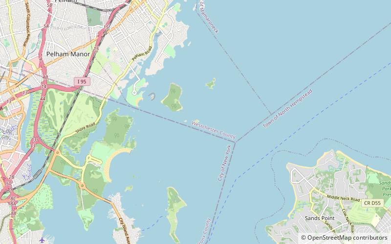
Sands Point Light, Baxter Preserve

Map
Facts and practical information
The Sands Point Lighthouse is located in Nassau County, New York, on Long Island, along its northern coast, in the Town of North Hempstead. The fourth lighthouse to be established on Long Island, this 1809 stone tower was built by an American Revolutionary War veteran who stayed on as its first keeper for many years. The Lighthouse is sometimes referred to the Mitchell Lighthouse, after Samuel L. Mitchell, the man who fought for it to be constructed. ()
Coordinates: 40°51'57"N, 73°43'46"W
Address
Sands PointBaxter Preserve
ContactAdd
Social media
Add
Day trips