Playing Angels, Philadelphia
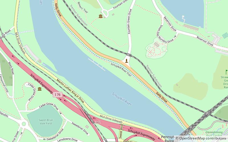
Map
Facts and practical information
Playing Angels is a sculpture series along the Schuylkill River and Kelly Drive in Philadelphia, Pennsylvania. It consists of three boy-shaped angels standing about six feet tall with wings and musical instruments. The bronze pieces are balanced on separate concrete pedestals overlooking the river bank and are about a mile away from Boathouse Row. ()
Coordinates: 39°58'49"N, 75°11'56"W
Address
Lower North (East Park)Philadelphia
ContactAdd
Social media
Add
Getting there by public transportation
Public transportation stops near this location
- Bus
- Tram
 Bus
Bus
- Calculate routeGirard Avenue & 34th Street 10 min walk
- Calculate routeSEPTA 33rd & Dauphin Bus Terminal 27 min walk
Maps SEPTA Regional Rail
SEPTA Regional RailDay trips


Frequently Asked Questions (FAQ)
Which popular attractions are close to Playing Angels?
Nearby attractions include Equestrian statue of Ulysses S. Grant, Philadelphia (2 min walk), Smith Memorial Playground & Playhouse, Philadelphia (6 min walk), Mount Pleasant Mansion, Philadelphia (6 min walk), Sweetbriar, Philadelphia (7 min walk).
How to get to Playing Angels by public transport?
The nearest stations to Playing Angels:
Tram
Bus
Tram
- Girard Avenue & 34th Street • Lines: 15 (10 min walk)
Bus
- SEPTA 33rd & Dauphin Bus Terminal (27 min walk)