Palm City, San Diego
Map
Facts and practical information
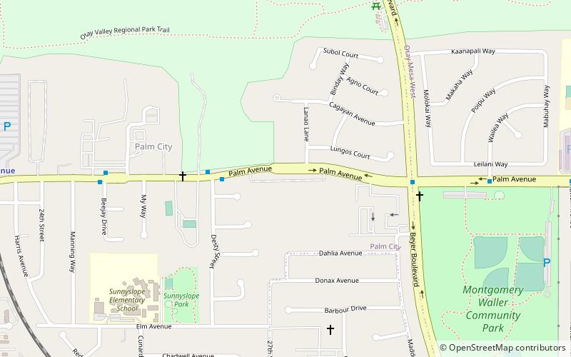
Palm City is a neighborhood in the southern section of San Diego. It neighbors Otay Mesa West to the south and east, Egger Highlands and Nestor to the west, and Chula Vista to the north. It also serves as a gateway to the beach cities of Imperial Beach, and Coronado, by way of the Silver Strand isthmus, due to it being where California State Route 75 meets Interstate 5. Major thoroughfares include Coronado Avenue, Hollister Street, Beyer Boulevard, and Palm Avenue. ()
Coordinates: 32°35'2"N, 117°4'30"W
Address
Southern San Diego (Palm City)San Diego
ContactAdd
Social media
Add
Getting there by public transportation
Public transportation stops near this location
- Bus
- Light rail
 Bus
Bus
- Calculate routePalm Avenue 14 min walk
- Calculate routeIris Avenue 28 min walk
- Calculate routePalm Avenue 14 min walk
- Calculate routeIris Ave Bus Station 29 min walk
- Calculate routeIris Avenue 29 min walk
Day trips


Frequently Asked Questions (FAQ)
How to get to Palm City by public transport?
The nearest stations to Palm City:
Light rail
Bus
Light rail
- Palm Avenue • Lines: 510 (14 min walk)
- Iris Avenue • Lines: 510 (28 min walk)
Bus
- Palm Avenue (14 min walk)
- Iris Ave Bus Station (29 min walk)