Curries Woods, Jersey City
Facts and practical information
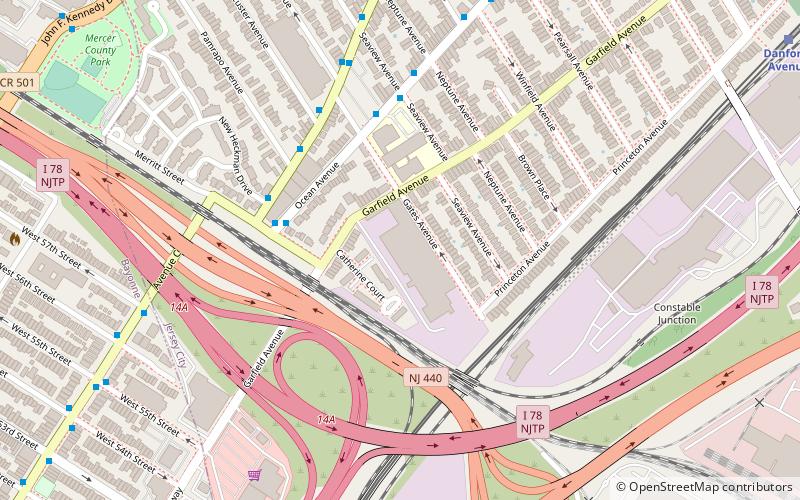
Curries Woods is a neighborhood in the southern part of Greenville in Jersey City, New Jersey bordering Bayonne. It was named after James Curie, who was on the town Committee for Greenville when it was its own Township in the 19th century. The area remained rural until the later part of the century when the Central Railroad of New Jersey built a line connecting ferries to Elizabeth, New Jersey and New York City. Currie's Woods still remained untouched through the late part of the century and it was valued for its woods, rocky shore and dunes on Newark Bay. A lot of the land was eventually lost, but a tract was set aside in the early part of the 20th century. A small cemetery, the Old Greenville Cemetery, was nearby. This park lost much of its land to the city's largest Housing Authority project in 1959, except a small tract in Bayonne, Mercer Park. ()
GreenvilleJersey City
- Bus
- Light rail
 Bus
Bus
- Calculate routeAvenue C at 54th Street 11 min walk
- Calculate routeJFK Boulevard at 63rd Street 12 min walk
- Calculate routeSociety Hill 30 min walk
- Calculate routeDanforth Avenue 13 min walk
- Calculate route45th Street 20 min walk
- Calculate routeRichard Street 30 min walk
Curries Woods – popular in the area (distance from the attraction)
Nearby attractions include: Liberty National Golf Club, St. Vincent de Paul Catholic Church, Bayview – New York Bay Cemetery, First Reformed Dutch Church of Bergen Neck.


Frequently Asked Questions (FAQ)
Which popular attractions are close to Curries Woods?
How to get to Curries Woods by public transport?
Bus
- Avenue C at 54th Street • Lines: 120 (11 min walk)
- JFK Boulevard at 63rd Street • Lines: 10, 119 (12 min walk)
Light rail
- Danforth Avenue • Lines: Hblr (13 min walk)
- 45th Street • Lines: Hblr (20 min walk)