Aurora Public Schools, Aurora
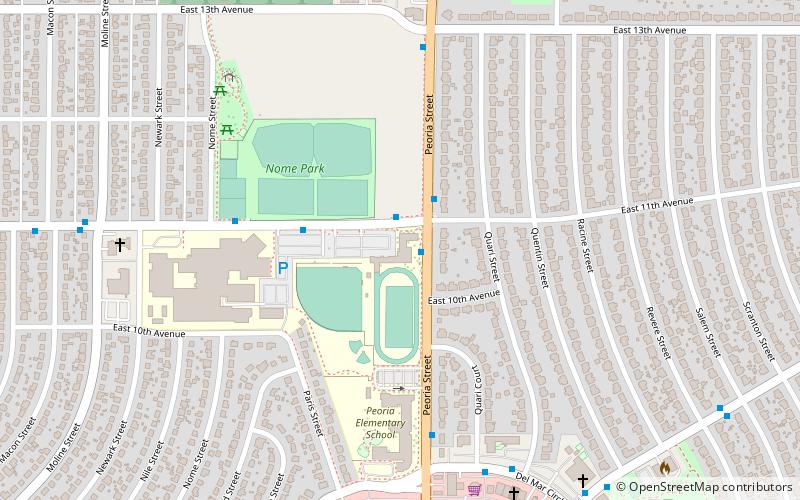
Map
Facts and practical information
The Adams-Arapahoe 28J School District, more commonly known as the Aurora Public Schools, is the public school system in Aurora, Colorado, United States. There are 65 schools in the district: four early childhood education centers, 27 elementary schools, six P/K-8 schools, six middle schools, one grades 6-12 academy, six high schools, one gifted and talented K-8 school, 12 charter schools, one of only five vocational–technical colleges in the state, and one home school support program. ()
Coordinates: 39°43'57"N, 104°50'52"W
Getting there by public transportation
Public transportation stops near this location
- Bus
- Light rail
 Bus
Bus
- Calculate routeDel Mar Circle & Quari Court 7 min walk
- Calculate routePeoria Street & Del Mar Circle North 8 min walk
- Calculate routeHoffman Boulevard & Del Mar Circle 9 min walk
- Calculate routeColfax 32 min walk
- Calculate route2nd Avenue & Abilene 38 min walk
Day trips


Frequently Asked Questions (FAQ)
How to get to Aurora Public Schools by public transport?
The nearest stations to Aurora Public Schools:
Bus
Light rail
Bus
- Del Mar Circle & Quari Court • Lines: 6 (7 min walk)
- Peoria Street & Del Mar Circle North • Lines: 6 (8 min walk)
Light rail
- Colfax • Lines: R (32 min walk)
- 2nd Avenue & Abilene • Lines: R (38 min walk)