Weinstock's, Sacramento
Facts and practical information
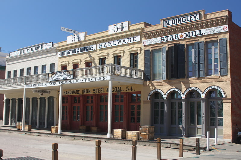
Weinstock's, originally Weinstock, Lubin, and Co. was an American department store chain headquartered in Sacramento, California. It was founded by Harris Weinstock and his half-brother, David Lubin. The chain was purchased by Hale's in 1949, becoming part of Broadway-Hale Stores, later Carter Hawley Hale. In 1978, Weinstock's expanded into Utah by rebranding its sister chain The Broadway's location at Fashion Place in Murray into that name, with two stores later in Ogden and Salt Lake City. In 1991, Weinstock's operations were later assumed by its other sister chain The Emporium. In 1993, Weinstock's closed its three Utah stores, eventually bringing Dillard's for the first time to Utah with its first store in Murray's former location. The chain was later purchased by Federated Department Stores in 1995, resulting in most of the Weinstock's stores to be converted to Macy's. Some of the remaining stores were either closed or sold, two of them to Gottschalks, at Vintage Faire Mall in Modesto and Fashion Fair in Fresno. This also brought Dillard's for the first time in California with its new store built in the former Weinstock's site at Weberstown Mall in Stockton ()
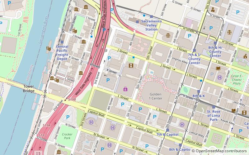
Central Sacramento (Downtown Sacramento)Sacramento
- Bus
- Light rail
- Train
 Bus
Bus
- Calculate routeJ St & 4th St 3 min walk
- Calculate routeSacramento 6 min walk
- Calculate routeSacramento Valley Station 7 min walk
- Calculate route7th & Capitol 7 min walk
- Calculate routeSacramento Valley Station 6 min walk
- Calculate route7th & Capitol 7 min walk
- Calculate routeCentral Pacific Freight Depot 7 min walk
- Calculate route8th & K 8 min walk
- Calculate routeSacramento Valley Station 7 min walk
- Calculate route7th & Capitol 7 min walk
- Calculate route7th & I/County Center 8 min walk
- Calculate route8th & K 8 min walk
Weinstock's – popular in the area (distance from the attraction)
Nearby attractions include: Old Sacramento, Crocker Art Museum, Downtown Commons, California State Railroad Museum.


Frequently Asked Questions (FAQ)
Which popular attractions are close to Weinstock's?
How to get to Weinstock's by public transport?
Bus
- J St & 4th St • Lines: 70, 99, Md (3 min walk)
- Sacramento • Lines: 2062, 2064 (6 min walk)
Train
- Sacramento Valley Station (6 min walk)
- 7th & Capitol (7 min walk)
Light rail
- Sacramento Valley Station • Lines: Gold (7 min walk)
- 7th & Capitol • Lines: Blue, Gold, Green (7 min walk)