Kenton Commercial Historic District, Portland
Map
Facts and practical information
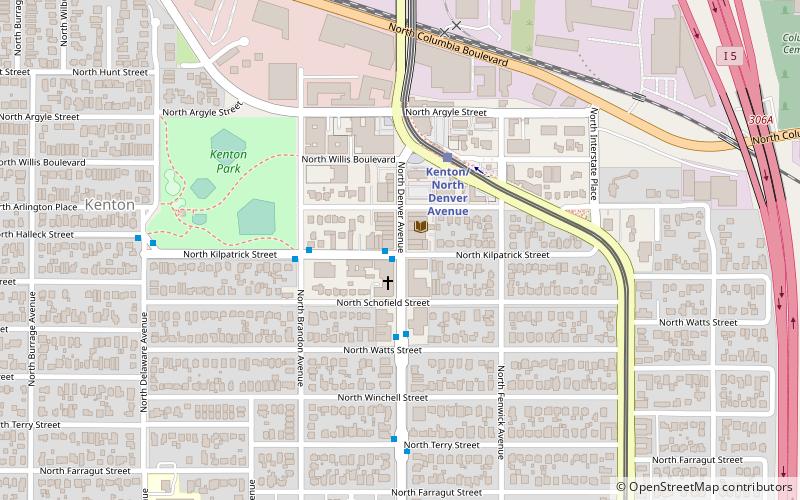
The Kenton Commercial Historic District is a historic district in north Portland, Oregon's Kenton neighborhood, in the United States. The district is listed on the National Register of Historic Places. ()
Area: 8.72 acres (0.0136 mi²)Coordinates: 45°34'57"N, 122°41'13"W
Address
North Portland (Kenton)Portland
ContactAdd
Social media
Add
Getting there by public transportation
Public transportation stops near this location
- Bus
- Light rail
 Bus
Bus
- Calculate routeNorth Kilpatrick & Denver 1 min walk
- Calculate routeNorth Denver & Terry 6 min walk
- Calculate routeKenton/North Denver Avenue 3 min walk
- Calculate routeNorth Lombard Transit Center 12 min walk
- Calculate routeRosa Parks 23 min walk
- Calculate routeDelta Park/Vanport 25 min walk
Day trips


Frequently Asked Questions (FAQ)
Which popular attractions are close to Kenton Commercial Historic District?
Nearby attractions include Kenton Library, Portland (2 min walk), Kenton Hotel, Portland (2 min walk), Statues of Paul Bunyan, Portland (3 min walk), Statue of Paul Bunyan, Portland (3 min walk).
How to get to Kenton Commercial Historic District by public transport?
The nearest stations to Kenton Commercial Historic District:
Bus
Light rail
Bus
- North Kilpatrick & Denver • Lines: 4 (1 min walk)
- North Denver & Terry • Lines: 4 (6 min walk)
Light rail
- Kenton/North Denver Avenue • Lines: Yellow (3 min walk)
- North Lombard Transit Center • Lines: Yellow (12 min walk)