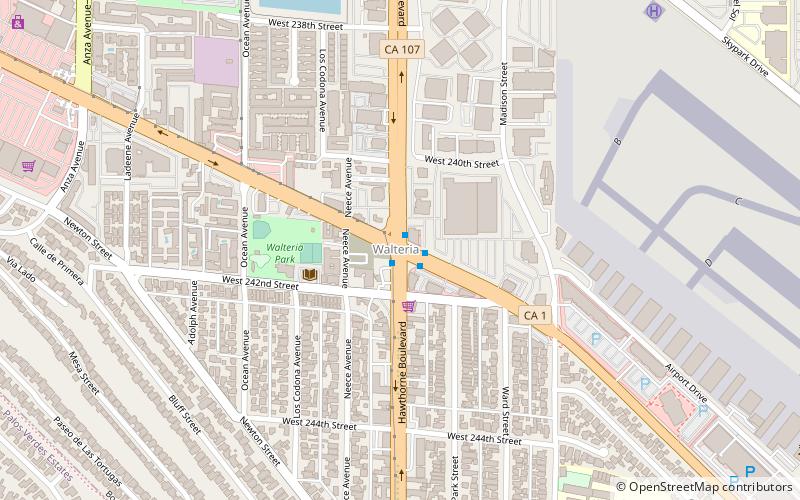
Walteria, Torrance
Map
Facts and practical information
Walteria is a region of the city of Torrance in southern California. It is south of the Pacific Coast Highway. The local zip code is 90505. Walteria is named after Captain A. Richard Walters of Atkinson, Illinois. Captain Walters moved to the California farming area in the 1880s and built a stagecoach stop, the Walters Hotel, on a main road connecting the salt works in Redondo Beach with the harbor in San Pedro. Residents are zoned to Walteria Elementary School, Richardson Middle School, and South High School. ()
Coordinates: 33°48'18"N, 118°21'4"W
Address
TorranceTorrance
ContactAdd
Social media
Add
Getting there by public transportation
Public transportation stops near this location
- Bus
 Bus
Bus
- Calculate routeLomita/Hawthorne 20 min walk
- Calculate routeLomita/Ocean 23 min walk
- Calculate routeLomita/Kent 27 min walk
Day trips


Frequently Asked Questions (FAQ)
How to get to Walteria by public transport?
The nearest stations to Walteria:
Bus
Bus
- Lomita/Hawthorne • Lines: 9 (20 min walk)
- Lomita/Ocean • Lines: 9 (23 min walk)