Gardenland, Sacramento
Map
Facts and practical information
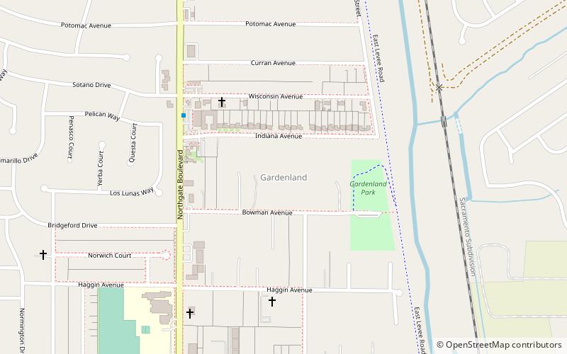
Gardenland is a neighborhood in the city of Sacramento, California, around the Natomas Basin. It borders Northgate Boulevard to the west, Indiana Avenue to the north, the East Levee Basin to the east, and the Arden-Garden Highway to the south. It is the richest agricultural area within city limits. ()
Coordinates: 38°37'6"N, 121°28'21"W
Address
North Sacramento (Gardenland)Sacramento
ContactAdd
Social media
Add
Getting there by public transportation
Public transportation stops near this location
- Bus
- Light rail
- Train
 Bus
Bus
- Calculate routeGlobe 29 min walk
- Calculate routeArden/Del Paso 31 min walk
- Calculate routeGlobe 29 min walk
- Calculate routeArden/Del Paso 31 min walk
- Calculate routeGlobe 29 min walk
- Calculate routeArden/Del Paso 31 min walk
Day trips


Frequently Asked Questions (FAQ)
How to get to Gardenland by public transport?
The nearest stations to Gardenland:
Light rail
Bus
Train
Light rail
- Globe • Lines: Blue (29 min walk)
- Arden/Del Paso • Lines: Blue (31 min walk)
Bus
- Globe (29 min walk)
- Arden/Del Paso (31 min walk)
Train
- Globe (29 min walk)
- Arden/Del Paso (31 min walk)