Westgate Plaza, Albany
Map
Facts and practical information
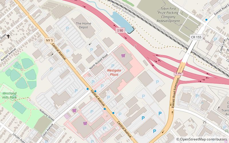
Westgate Plaza is a large strip mall in the city of Albany, New York, located on Central Avenue. Westgate is considered the first mall in the Albany area, and opened in 1957. ()
Coordinates: 42°40'57"N, 73°47'24"W
Address
West AlbanyAlbany
ContactAdd
Social media
Add
Getting there by public transportation
Public transportation stops near this location
- Bus
 Bus
Bus
- Calculate routeWest Mall 4 min walk
- Calculate routeNorth Allen 18 min walk
- Calculate routeNorth Manning 24 min walk
- Calculate routeHillcrest Avenue 35 min walk
Day trips


Frequently Asked Questions (FAQ)
How to get to Westgate Plaza by public transport?
The nearest stations to Westgate Plaza:
Bus
Bus
- West Mall • Lines: 905 (4 min walk)
- North Allen • Lines: 905 (18 min walk)