Jabberjaw, Los Angeles
Map
Facts and practical information
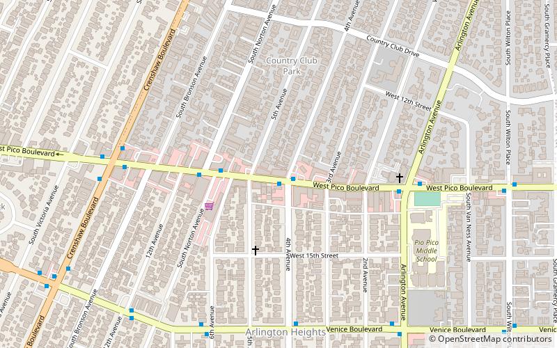
Jabberjaw was a coffeehouse and music venue in Los Angeles, California known for its all-ages underground rock music shows. Located in Arlington Heights at 3711 Pico Blvd, it was established in 1989 by Gary Dent and Michelle Carr and closed in 1997. ()
Coordinates: 34°2'51"N, 118°19'18"W
Address
Central Los Angeles (Olympic Park)Los Angeles
ContactAdd
Social media
Add
Getting there by public transportation
Public transportation stops near this location
- Metro
- Bus
 Metro
Metro
- Calculate routePico & Crenshaw 8 min walk
- Calculate routeCrenshaw & Olympic 13 min walk
- Calculate routeWilshire/Western 33 min walk
Maps Metro & Regional Rail
Metro & Regional RailDay trips


Frequently Asked Questions (FAQ)
Which popular attractions are close to Jabberjaw?
Nearby attractions include Country Club Park, Los Angeles (5 min walk), Angelus Vista, Los Angeles (7 min walk), Holmes-Shannon House, Los Angeles (10 min walk), Washington Irving Branch, Los Angeles (15 min walk).
How to get to Jabberjaw by public transport?
The nearest stations to Jabberjaw:
Bus
Metro
Bus
- Pico & Crenshaw • Lines: 7, Express 7, Rapid 7 (8 min walk)
- Crenshaw & Olympic • Lines: 7, Rapid 7 (13 min walk)
Metro
- Wilshire/Western • Lines: D (33 min walk)