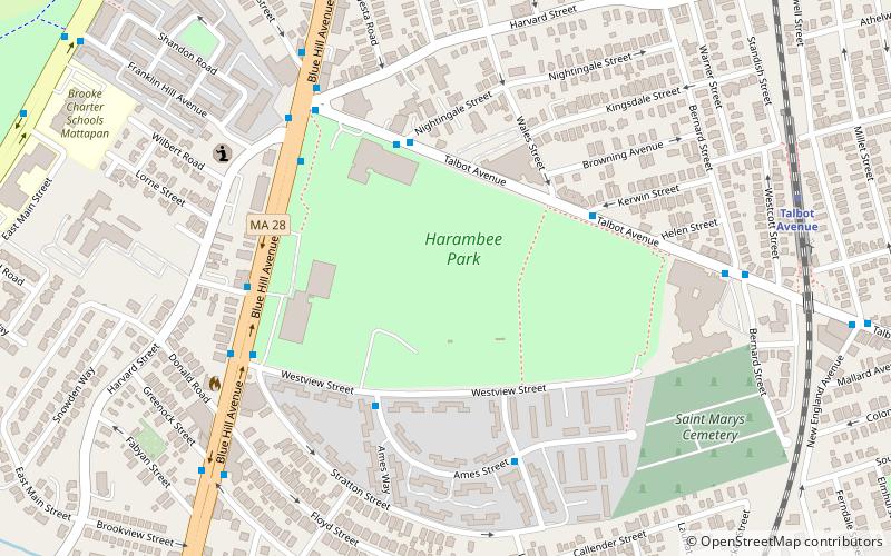
Harambee Park, Boston
Map
Facts and practical information
Harambee Park is a park located in Dorchester and Mattapan, Boston. Originally known as Franklin Field, it was designed by Frederick Law Olmsted in order to give Bostonians a place to play sports, as well as prevent them from doing it at nearby Franklin Park. During its operation, it has hosted baseball, cricket, and a speedway. Today, the park operates as Harambee Park, and part of the grounds have been turned into a housing project. ()
Elevation: 52 ft a.s.l.Coordinates: 42°17'33"N, 71°5'7"W
Address
Greater Mattapan (Franklin Field South)Boston
ContactAdd
Social media
Add
Getting there by public transportation
Public transportation stops near this location
- Metro
- Bus
- Light rail
- Train
 Metro
Metro
- Calculate routeTalbot Avenue 10 min walk
- Calculate routeMorton Street 22 min walk
- Calculate routeFour Corners/Geneva 25 min walk
- Calculate routeWashington St @ Wheatland Ave 18 min walk
- Calculate routeShawmut 26 min walk
- Calculate routeAshmont/Peabody Square 32 min walk
- Calculate routeAshmont/Peabody Square 33 min walk
Maps MBTA Subway
MBTA SubwayDay trips


Frequently Asked Questions (FAQ)
Which popular attractions are close to Harambee Park?
Nearby attractions include Buildings at 825–829 Blue Hill Avenue, Boston (9 min walk), Esmond Street Historic District, Boston (10 min walk), Morton Street, Boston (13 min walk), Thane Street Historic District, Boston (14 min walk).
How to get to Harambee Park by public transport?
The nearest stations to Harambee Park:
Train
Bus
Metro
Light rail
Train
- Talbot Avenue (10 min walk)
- Morton Street (22 min walk)
Bus
- Washington St @ Wheatland Ave • Lines: 23 (18 min walk)
Metro
- Shawmut • Lines: Red (26 min walk)
- Ashmont/Peabody Square • Lines: Red (32 min walk)
Light rail
- Ashmont/Peabody Square • Lines: M (33 min walk)