Waldo, Kansas City
Map
Facts and practical information
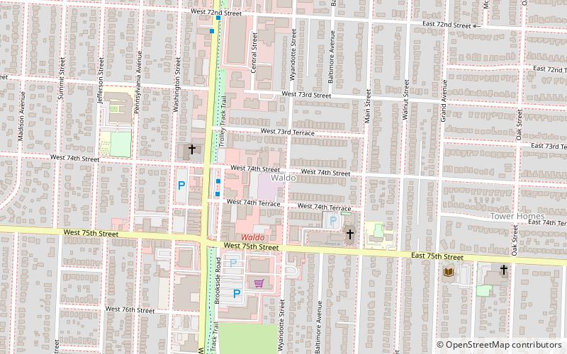
Waldo is a neighborhood located in south Kansas City, Missouri, that has continued to maintain its own unique character, even though it was annexed by Kansas City in 1909. Waldo's boundaries are Gregory Boulevard on the north to 85th Street on the south, and Holmes Street on the east to Ward Parkway on the west. ()
Coordinates: 38°59'38"N, 94°35'31"W
Address
South Side (Waldo)Kansas City
ContactAdd
Social media
Add
Getting there by public transportation
Public transportation stops near this location
- Bus
 Bus
Bus
- Calculate routeBroadway at 74th Terrace 3 min walk
- Calculate routeWornall at 70th 15 min walk
Day trips


Frequently Asked Questions (FAQ)
Which popular attractions are close to Waldo?
Nearby attractions include Waldo Water Tower, Kansas City (15 min walk), Armour Hills, Kansas City (22 min walk).
How to get to Waldo by public transport?
The nearest stations to Waldo:
Bus
Bus
- Broadway at 74th Terrace • Lines: Mmax (3 min walk)
- Wornall at 70th • Lines: Mmax (15 min walk)