Stuart Area Historic District, Kalamazoo

Gallery (1)
Map
Map
Facts and practical information
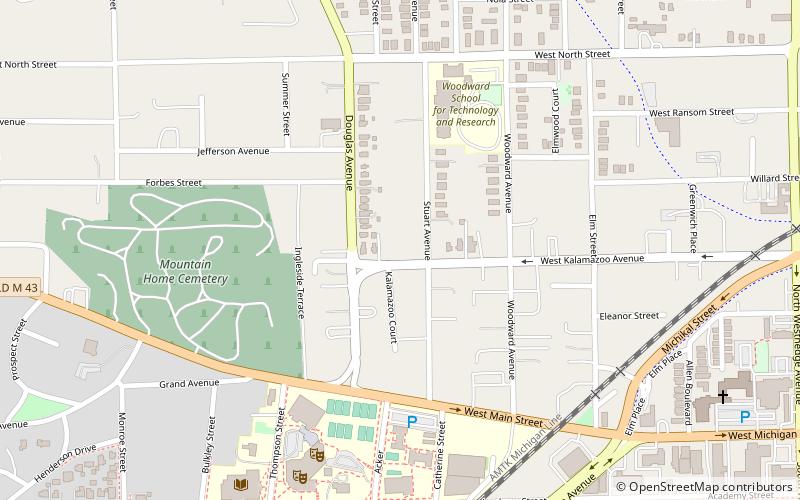
The Stuart Area Historic District is a primarily residential historic district Roughly bounded by the Michigan Central RR, Douglas, Forbes, West Main, North, and Elm Streets, and Kalamazoo and Grand Avenues, in Kalamazoo, Michigan. The bulk of the district was listed on the National Register of Historic Places in 1983, with additions in 1995. ()
Coordinates: 42°17'40"N, 85°35'54"W
Address
StuartKalamazoo
ContactAdd
Social media
Add
Getting there by public transportation
Public transportation stops near this location
- Bus
- Train
 Bus
Bus
- Calculate routeKalamazoo 19 min walk
- Calculate routeKalamazoo Transportation Center 19 min walk
Day trips


Frequently Asked Questions (FAQ)
Which popular attractions are close to Stuart Area Historic District?
Nearby attractions include Kalamazoo College, Kalamazoo (10 min walk), Henderson Castle, Kalamazoo (10 min walk), Cathedral of Saint Augustine, Kalamazoo (10 min walk), Alonzo T. Prentice House, Kalamazoo (12 min walk).
How to get to Stuart Area Historic District by public transport?
The nearest stations to Stuart Area Historic District:
Train
Bus
Train
- Kalamazoo (19 min walk)
Bus
- Kalamazoo Transportation Center (19 min walk)