Angel's Triangle, El Paso
Facts and practical information
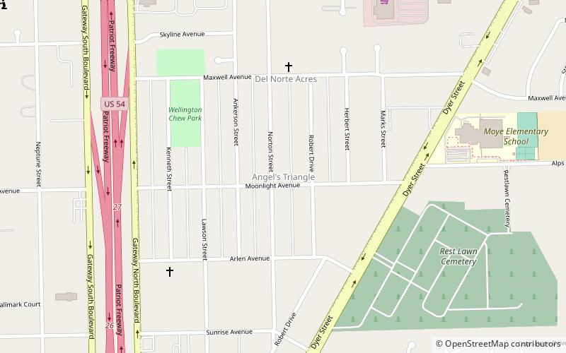
Angel's Triangle is a neighborhood located in Northeast El Paso in El Paso, Texas. It lies within a right triangle bordered by Dyer Street on the east, the Patriot Freeway on the west, and Hondo Pass Avenue on the north. Dominated by apartment complexes and older duplexes or single-family homes with a high poverty rate among its residents, and once notorious for crime, drug trafficking and prostitution, it was known as the Devil's Triangle before being officially renamed at a meeting of its residents in the 1990s. and is still sometimes referred to as such, or as the Triangle. The neighborhood's commercial portion is along its eastern and northern edges, on Dyer and on Hondo Pass, respectively; there is almost no business development along Gateway North Boulevard at the western edge of the Angel's Triangle. ()
Notheast El Paso (Angel's Triangle)El Paso
- Bus
 Bus
Bus
- Calculate routeBay A 29 min walk
- Calculate routeBay B 29 min walk
- Calculate routeBay C 30 min walk
- Calculate routeBay D 30 min walk


Frequently Asked Questions (FAQ)
How to get to Angel's Triangle by public transport?
Bus
- Bay A • Lines: 46, 80 (29 min walk)
- Bay B • Lines: 45 (29 min walk)