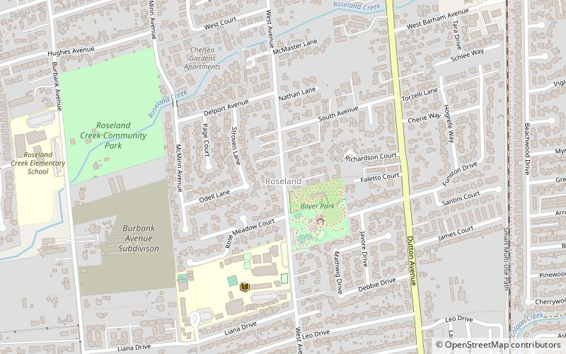
Roseland, Santa Rosa
Map
Facts and practical information
Roseland is a neighborhood in Santa Rosa, California. As of the 2010 census, the population was 6,325. Roseland was an unincorporated enclave within the City of Santa Rosa until the area was annexed by Santa Rosa on November 1, 2017. ()
Address
Southwest Santa Rosa (Sunset McMinn)Santa Rosa
ContactAdd
Social media
Add
Getting there by public transportation
Public transportation stops near this location
- Bus
- Train
 Bus
Bus
- Calculate routeWestside Park Transit Hub 17 min walk
- Calculate routeSanta Rosa Transit Mall 35 min walk
- Calculate routeSanta Rosa Transit Mall Platform N1 36 min walk
- Calculate routeSanta Rosa Downtown 29 min walk
Day trips


Frequently Asked Questions (FAQ)
How to get to Roseland by public transport?
The nearest stations to Roseland:
Bus
Train
Bus
- Westside Park Transit Hub (17 min walk)
- Santa Rosa Transit Mall (35 min walk)
Train
- Santa Rosa Downtown (29 min walk)