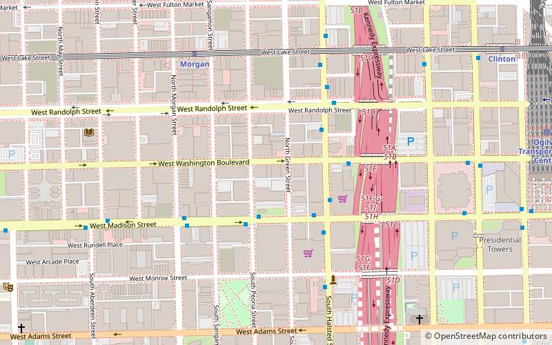
Halsted Street, Chicago
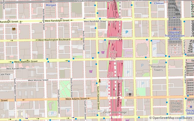
Map
Facts and practical information
Halsted Street is a major north-south street in the U.S. city of Chicago, Illinois. ()
Coordinates: 41°52'54"N, 87°38'51"W
Address
West Side (Near West Side)Chicago
ContactAdd
Social media
Add
Getting there by public transportation
Public transportation stops near this location
- Metro
- Bus
- Train
 Metro
Metro
- Calculate routeHalsted & Madison 1 min walk
- Calculate routeMadison & Halsted 1 min walk
- Calculate routeHalsted & Monroe 3 min walk
- Calculate routeWashington & Halsted 3 min walk
- Calculate routeMorgan 9 min walk
- Calculate routeClinton 11 min walk
- Calculate routeUIC-Halsted 12 min walk
- Calculate routeOgilvie Transportation Center 10 min walk
- Calculate routeChicago Union Station 13 min walk
- Calculate routeLaSalle Street Station 23 min walk
Maps Rail "L"
Rail "L"Day trips


Frequently Asked Questions (FAQ)
Which popular attractions are close to Halsted Street?
Nearby attractions include Kavi Gupta Gallery, Chicago (3 min walk), Old St. Patrick's Church, Chicago (6 min walk), Batcolumn, Chicago (6 min walk), Greektown, Chicago (6 min walk).
How to get to Halsted Street by public transport?
The nearest stations to Halsted Street:
Bus
Metro
Train
Bus
- Halsted & Madison • Lines: 20, 8, (N) N20 (1 min walk)
- Madison & Halsted • Lines: 20, 8, (N) N20 (1 min walk)
Metro
- Morgan • Lines: Green, Pink (9 min walk)
- Clinton • Lines: Green, Pink (11 min walk)
Train
- Ogilvie Transportation Center (10 min walk)
- Chicago Union Station (13 min walk)