African Episcopal Church of St. Thomas, Philadelphia
Facts and practical information
The African Episcopal Church of St. Thomas was founded in 1792 in Philadelphia, Pennsylvania, as the first black Episcopal Church in the United States. Its congregation developed from the Free African Society, a non-denominational group formed by blacks who had left St. George's Methodist Church because of discrimination and segregation by class. They were led by Absalom Jones, a free black and lay Methodist preacher. As his congregation became established, he was ordained in 1802 by Presiding Bishop William White as the first black priest in the Episcopal Church. Bishop White also ordained William Levington as a deacon at this church, although he soon became a missionary in the South, establishing St. James Church in Baltimore in 1824. ()
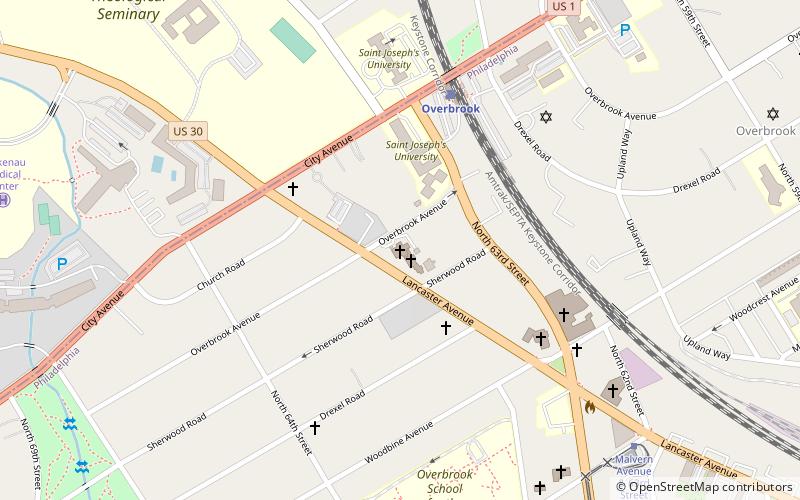
6361 Lancaster AvenueWest Philadelphia (Overbrook)Philadelphia
- Bus
- Tram
- Train
 Bus
Bus
- Calculate routeOverbrook 5 min walk
- Calculate routeMerion 19 min walk
- Calculate routeWynnewood 41 min walk
- Calculate routeMalvern Avenue & 63rd Street 9 min walk
- Calculate routeMalvern Avenue & 63rd Street 9 min walk
- Calculate route63rd Street & Jefferson Street 18 min walk
 SEPTA Regional Rail
African Episcopal Church of St. Thomas – popular in the area (distance from the attraction)
Nearby attractions include: City Line Avenue Bridge, Arboretum of the Barnes Foundation, Bawa Muhaiyaddeen Fellowship, Merion Botanical Park.


Frequently Asked Questions (FAQ)
Which popular attractions are close to African Episcopal Church of St. Thomas?
How to get to African Episcopal Church of St. Thomas by public transport?
Train
- Overbrook (5 min walk)
- Merion (19 min walk)
Bus
- Malvern Avenue & 63rd Street (9 min walk)
Tram
- Malvern Avenue & 63rd Street • Lines: 10 (9 min walk)
- 63rd Street & Jefferson Street • Lines: 10 (18 min walk)