Kathryn Johnston Memorial Park, Atlanta
Map
Facts and practical information
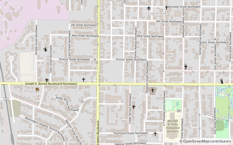
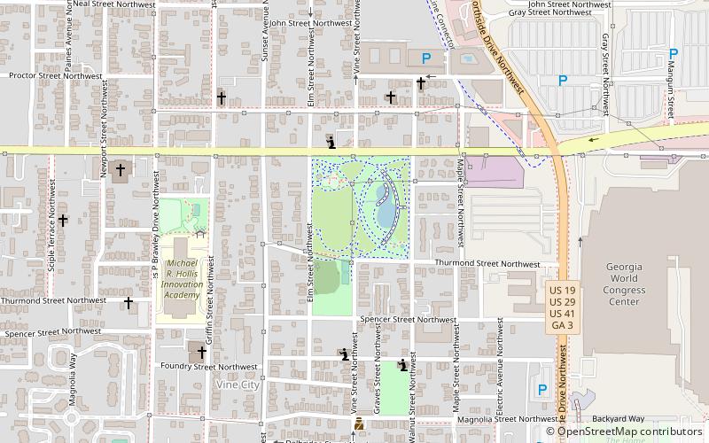
Kathryn Johnston Memorial Park is a park in the English Avenue neighborhood of Atlanta, Georgia, United States. ()
Elevation: 896 ft a.s.l.Coordinates: 33°45'51"N, 84°24'58"W
Address
Westside (English Avenue)Atlanta
ContactAdd
Social media
Add
Getting there by public transportation
Public transportation stops near this location
- Metro
- Bus
 Metro
Metro
- Calculate routeAshby 14 min walk
- Calculate routeVine City 23 min walk
- Calculate routeBankhead 24 min walk
- Calculate routeGWCC/CNN Center 32 min walk
- Calculate routeAtlanta Greyhound Bus Station 40 min walk
Day trips


Frequently Asked Questions (FAQ)
Which popular attractions are close to Kathryn Johnston Memorial Park?
Nearby attractions include Lindsay Street Park, Atlanta (10 min walk), Rodney Cook Sr. Park, Atlanta (13 min walk), Bankhead, Atlanta (14 min walk), Maddox Park, Atlanta (17 min walk).
How to get to Kathryn Johnston Memorial Park by public transport?
The nearest stations to Kathryn Johnston Memorial Park:
Metro
Bus
Metro
- Ashby • Lines: Blue, Green (14 min walk)
- Vine City • Lines: Blue, Green (23 min walk)
Bus
- Atlanta Greyhound Bus Station (40 min walk)