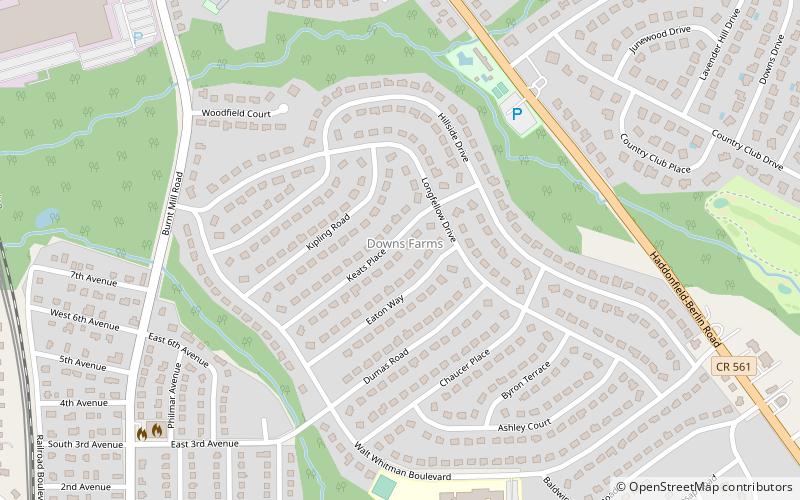
Downs Farm, Cherry Hill
Map
Facts and practical information
Downs Farm is a neighborhood located within Cherry Hill in Camden County, New Jersey, United States. ()
Coordinates: 39°52'4"N, 75°0'5"W
Address
Cherry Hill
ContactAdd
Social media
Add
Getting there by public transportation
Public transportation stops near this location
- Metro
 Metro
Metro
- Calculate routeWoodcrest 14 min walk
- Calculate routeAshland 19 min walk
Day trips


Frequently Asked Questions (FAQ)
Which popular attractions are close to Downs Farm?
Nearby attractions include Ashland, Cherry Hill (18 min walk), Coffins Corner, Cherry Hill (22 min walk).
How to get to Downs Farm by public transport?
The nearest stations to Downs Farm:
Metro
Metro
- Woodcrest • Lines: Patco (14 min walk)
- Ashland • Lines: Patco (19 min walk)