Scenic Brook, Austin
Map
Facts and practical information
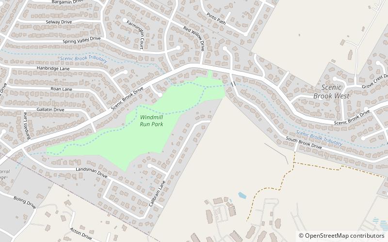
Scenic Brook is a neighborhood located in southwest Austin, Texas. Scenic Brook is located in ZIP codes 78735 and 78736. The boundaries are the intersections of Highway 290 and Highway 71 to on the north, south, and east sides, and Covered Bridge Drive and Scenic Brook Drive on the west side. The Pinnacle Campus of Austin Community College is a landmark on the southeast side of the neighborhood. ()
Coordinates: 30°14'12"N, 97°53'26"W
Address
Oak Hill (West Oak Hill)Austin
ContactAdd
Social media
Add
Getting there by public transportation
Public transportation stops near this location
- Bus
 Bus
Bus
- Calculate routeAcc Pinnacle South Entrance 15 min walk
Day trips


Frequently Asked Questions (FAQ)
How to get to Scenic Brook by public transport?
The nearest stations to Scenic Brook:
Bus
Bus
- Acc Pinnacle South Entrance (15 min walk)