Grand Canyon Unified School District, Grand Canyon National Park
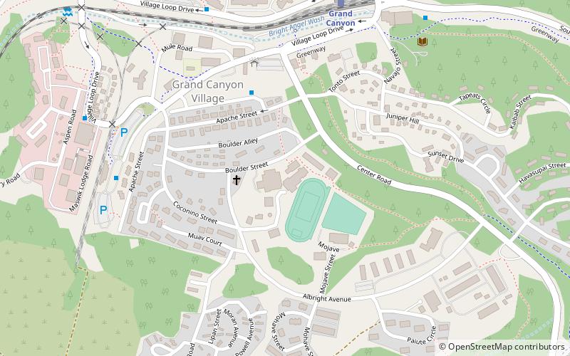
Map
Facts and practical information
The Grand Canyon Unified School District #4 is a school district located in Grand Canyon Village in unincorporated Coconino County, Arizona, United States. ()
Coordinates: 36°3'9"N, 112°8'18"W
Getting there by public transportation
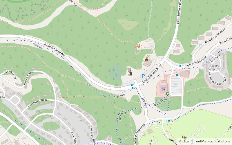
Public transportation stops near this location
- Bus
- Train
 Bus
Bus
- Calculate routeCenter Road 6 min walk
- Calculate routeBackcountry Information Center 8 min walk
- Calculate routeBright Angel Lodge 8 min walk
- Calculate routeTrain Depot 9 min walk
- Calculate routeGrand Canyon 8 min walk
Day trips


Frequently Asked Questions (FAQ)
Which popular attractions are close to Grand Canyon Unified School District?
Nearby attractions include Bright Angel Lodge, Grand Canyon National Park (8 min walk), Hopi House, Grand Canyon National Park (10 min walk), Bright Angel Trail, Grand Canyon National Park (12 min walk), Kolb Studio, Grand Canyon National Park (12 min walk).
How to get to Grand Canyon Unified School District by public transport?
The nearest stations to Grand Canyon Unified School District:
Bus
Train
Bus
- Center Road • Lines: Village Route (East-bound) (6 min walk)
- Backcountry Information Center • Lines: Village Route (East-bound) (8 min walk)
Train
- Grand Canyon (8 min walk)