Riverdale Temple, New York City
Map
Facts and practical information
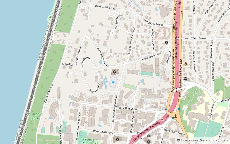
The Riverdale Temple is a Reform synagogue in the Riverdale neighborhood of the Bronx, New York City. The congregation was founded in 1947. ()
Coordinates: 40°53'30"N, 73°54'46"W
Address
4545 Independence AvenueWest Bronx (Riverdale)New York City
ContactAdd
Social media
Add
Getting there by public transportation
Public transportation stops near this location
- Metro
- Bus
- Train
 Metro
Metro
- Calculate routeVan Cortlandt Park–242nd Street 20 min walk
- Calculate route238th Street 21 min walk
- Calculate route231st Street 26 min walk
- Calculate routeRiverdale 23 min walk
- Calculate routeSpuyten Duyvil 26 min walk
- Calculate routeMarble Hill 30 min walk
- Calculate routeGoulden Avenue & Bedford Park Boulevard West 38 min walk
Maps SubwayMaps
 Manhattan Buses
SubwayMapsManhattan BusesDay trips


Frequently Asked Questions (FAQ)
Which popular attractions are close to Riverdale Temple?
Nearby attractions include Riverdale, New York City (5 min walk), Riverdale Jewish Center, New York City (7 min walk), Riverdale Monument, New York City (8 min walk), Riverdale Presbyterian Church, New York City (10 min walk).
How to get to Riverdale Temple by public transport?
The nearest stations to Riverdale Temple:
Metro
Train
Bus
Metro
- Van Cortlandt Park–242nd Street • Lines: 1 (20 min walk)
- 238th Street • Lines: 1 (21 min walk)
Train
- Riverdale (23 min walk)
- Spuyten Duyvil (26 min walk)
Bus
- Goulden Avenue & Bedford Park Boulevard West • Lines: Bx22 (38 min walk)