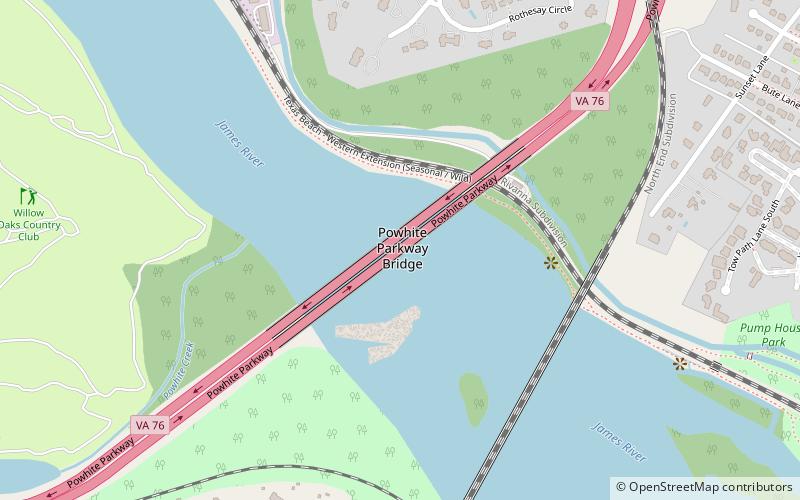
Powhite Parkway Bridge, Richmond
Map
Facts and practical information
Powhite Parkway Bridge crosses the James River in the independent city of Richmond, Virginia. It carries the Powhite Parkway, also known as Virginia State Route 76. The bridge is owned and maintained by the Richmond Metropolitan Authority, and was funded with revenue bonds which are repaid from user tolls. There is no bridge toll to cross the Powhite Parkway Bridge, however the toll plazas located south of the bridge prohibit drivers from crossing the bridge without paying a Powhite Parkway toll. ()
Coordinates: 37°32'21"N, 77°29'46"W
Address
Fan - Oregon Hill - Carver (Carillon)Richmond
ContactAdd
Social media
Add
Getting there by public transportation
Public transportation stops near this location
- Bus
 Bus
Bus
- Calculate routeMain & Boulevard 38 min walk
Day trips


Frequently Asked Questions (FAQ)
Which popular attractions are close to Powhite Parkway Bridge?
Nearby attractions include CSX A-Line Bridge, Richmond (6 min walk), New Pump-House, Richmond (15 min walk), James River and Kanawha Canal, Richmond (16 min walk), Byrd Park, Richmond (19 min walk).
How to get to Powhite Parkway Bridge by public transport?
The nearest stations to Powhite Parkway Bridge:
Bus
Bus
- Main & Boulevard • Lines: 20, 78 (38 min walk)