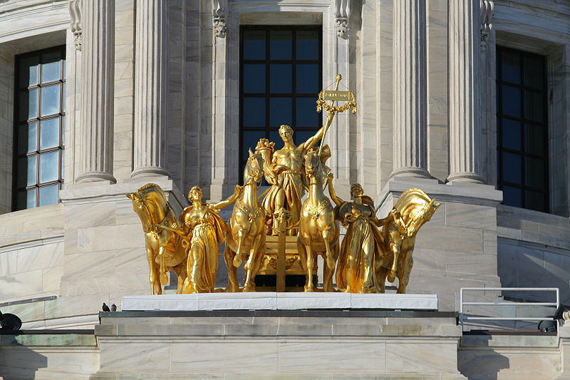
Progress of the State, Saint Paul

Gallery (3)
Map
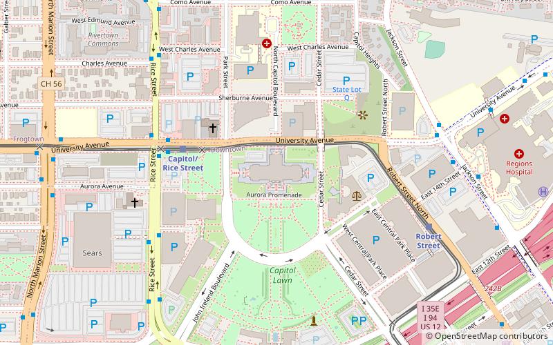
Map
Gallery
Facts and practical information
Progress of the State is the title of a group of sculptural figures that sits above the south portico, at the main entrance to the Minnesota State Capitol in Saint Paul, the state capital of the U.S. state of Minnesota. ()
Coordinates: 44°57'19"N, 93°6'8"W
Address
Downtown St. PaulSaint Paul
ContactAdd
Social media
Add
Getting there by public transportation
Public transportation stops near this location
- Bus
- Light rail
- Train
 Bus
Bus
- Calculate routeCapitol/Rice Street 4 min walk
- Calculate routeRobert Street 7 min walk
- Calculate route10th Street 10 min walk
- Calculate routeWestern Avenue 18 min walk
- Calculate routeUniversity Av 6 min walk
- Calculate routeSears 6 min walk
- Calculate routeCharles Av 7 min walk
- Calculate routeSaint Paul Union Depot 27 min walk
Day trips


Frequently Asked Questions (FAQ)
Which popular attractions are close to Progress of the State?
Nearby attractions include Minnesota State Capitol, Saint Paul (1 min walk), Minnesota State Law Library, Saint Paul (3 min walk), Christ Lutheran, Saint Paul (4 min walk), Minnesota Woman Suffrage Memorial, Saint Paul (4 min walk).
How to get to Progress of the State by public transport?
The nearest stations to Progress of the State:
Light rail
Bus
Train
Light rail
- Capitol/Rice Street • Lines: 902 (4 min walk)
- Robert Street • Lines: 902 (7 min walk)
Bus
- University Av • Lines: 3A, 3B, 67, 67A, 67C (6 min walk)
- Sears • Lines: 3A, 3B, 67, 67A, 67C (6 min walk)
Train
- Saint Paul Union Depot (27 min walk)