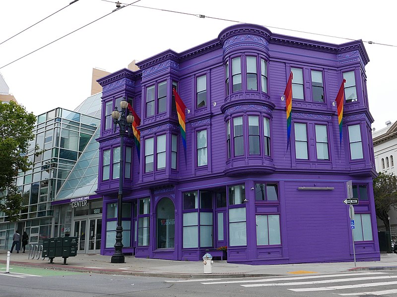
SF LGBT Center, San Francisco

Gallery (3)
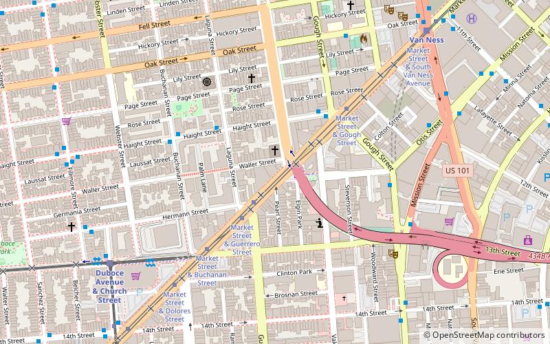
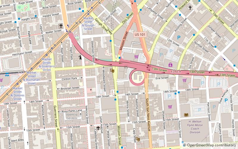
Map
Map
Gallery
Facts and practical information
The SF LGBT Center is a nonprofit organization serving the lesbian, gay, bisexual, transgender, and queer community of San Francisco, California, and nearby communities, located at 1800 Market Street in San Francisco. The mission of the SF LGBT Center is "to connect the diverse LGBTQ+ community to opportunities, resources, and each other to achieve a stronger, healthier, and more equitable world for LGBTQ+ people and our allies." ()
Coordinates: 37°46'18"N, 122°25'26"W
Getting there by public transportation
Public transportation stops near this location
- Metro
- Bus
- Trolleybus
- Tram
- Light rail
 Metro
Metro
- Calculate routeMarket Street & Laguna Street 2 min walk
- Calculate routeHaight Street & Laguna Street 4 min walk
- Calculate route150 Otis Street 6 min walk
- Calculate route150 Otis Street 6 min walk
- Calculate routeMission Street & 13th Street 7 min walk
- Calculate routeOtis Street & 12th Street 8 min walk
- Calculate routeChurch Street & Duboce Avenue 9 min walk
- Calculate routeDuboce Avenue & Church Street 9 min walk
- Calculate routeChurch Street & Duboce Avenue 9 min walk
- Calculate routeVan Ness 10 min walk
- Calculate route16th Street Mission 13 min walk
- Calculate routeCivic Center 20 min walk
Maps Muni Metro
Muni MetroDay trips
SF LGBT Center – popular in the area (distance from the attraction)
Nearby attractions include: Mission Workshop, Wiggle Bicycles, Market Street, Mission Dolores.


Frequently Asked Questions (FAQ)
When is SF LGBT Center open?
SF LGBT Center is open:
- Monday 12 pm - 10 pm
- Tuesday 12 pm - 10 pm
- Wednesday 12 pm - 10 pm
- Thursday 12 pm - 10 pm
- Friday 12 pm - 6 pm
- Saturday 9 am - 6 pm
- Sunday closed
Which popular attractions are close to SF LGBT Center?
Nearby attractions include Octavia Boulevard, San Francisco (3 min walk), San Francisco Zen Center, San Francisco (5 min walk), California Volunteers Sculpture, San Francisco (7 min walk), Southern Exposure, San Francisco (7 min walk).
How to get to SF LGBT Center by public transport?
The nearest stations to SF LGBT Center:
Tram
Bus
Trolleybus
Light rail
Metro
Tram
- Market Street & Laguna Street • Lines: F (2 min walk)
Bus
- Haight Street & Laguna Street • Lines: 7 (4 min walk)
- 150 Otis Street • Lines: 49 (6 min walk)
Trolleybus
- 150 Otis Street • Lines: 14 (6 min walk)
- Mission Street & 13th Street • Lines: 14 (7 min walk)
Light rail
- Duboce Avenue & Church Street • Lines: N (9 min walk)
- Church Street & Duboce Avenue • Lines: J (9 min walk)
Metro
- 16th Street Mission • Lines: Blue, Green, Red, Yellow (13 min walk)
- Civic Center • Lines: Blue, Green, Red, Yellow (20 min walk)