Trek Zone

South Puyallup River Bridge, Mount Rainier National Park

#112 among attractions in Mount Rainier National Park

Bridge
South Puyallup River Bridge

Facts and practical information
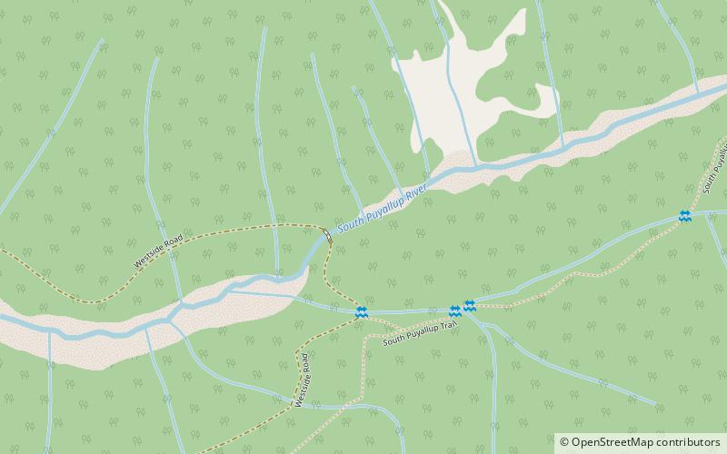
Built: 1931 (93 years ago)Coordinates: 46°48'29"N, 121°53'28"W
Address

Mount Rainier National Park United States

ContactAdd
Social media
Add

Mount Rainier National Park plan & book

Unleash the traveler in you — discover the cheapest flight deals, find the perfect hotel or hostel nearby, and search for the best car rental prices. Travel at your own pace to discover new places and enjoy your journey.

Day trips

South Puyallup River Bridge – popular in the area (distance from the attraction)

Nearby attractions include: Comet Falls, Upper Comet Falls, Mount Wow, Van Trump Falls.

  • comet falls mount rainier national park5.3 miE
  • upper comet falls mount rainier national park location map
    5.4 miE
  • mount wow mount rainier national park2.5 miS
  • van trump falls mount rainier national park location map
    5.3 miE
  • glacier view wilderness2.1 miSW
  • tahoma glacier mount rainier national park4.5 miNE
  • kautz creek falls mount rainier national park location map
    5.2 miE
  • south tahoma glacier mount rainier national park location map
    4.5 miE
  • south mowich glacier mount rainier national park location map
    5.3 miNE
  • success glacier mount rainier national park location map
    5.4 miE
  • edmunds glacier mount rainier national park location map
    5.5 miNE

Where to next? Visit washington Washington region page or discover the top tourist attractions in United States.