Eastern Tepuis, Formaciones de Tepuyes Natural Monument


Facts and practical information
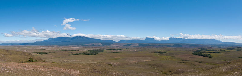
The Eastern Tepuis, also known as the Roraima–Ilú range, is a mountain chain stretching for some 60 kilometres along the border between the disputed territory of Guayana Esequiba in Guyana, Venezuela and, to a small extent, Brazil. It runs in a northwesterly direction from the tripoint of these countries, closely following the Guyana–Venezuela border, with a single major peak to the south, on the Brazil–Venezuela border. Moving northwest from Uei-tepui, the main summits of this chain are Roraima-tepui, Kukenán-tepui, Yuruaní-tepui, Wadakapiapué-tepui, Karaurín-tepui, Ilú-tepui, and Tramen-tepui. The minor peak of Wei-Assipu-tepui lies entirely outside Venezuela, on the border between Brazil and Guyana. Additionally, there are a number of minor plateaus which form a chain between Uei-tepui and Roraima-tepui. Ilú- and Tramen-tepuis are often treated together since they are joined by a common base. ()
Formaciones de Tepuyes Natural Monument

