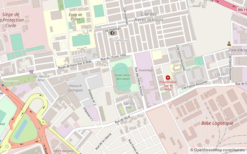
Omar Benrabah Stadium, Algiers
Map
Facts and practical information
Omar Benrabah Stadium is a multi-use stadium located in the Dar El Beïda district of Algiers, Algeria. It is currently used mostly for football matches. It is frequently used by the Algeria A' national football team and the Algerian Under-23 National Team. also is the home ground of Paradou AC and CRB Dar El Beïda. The stadium holds 11,000 spectators. ()
Address
الدار البيضاء دائرة (الدار البيضاء)Algiers
ContactAdd
Social media
Add
Getting there by public transportation
Public transportation stops near this location
- Bus
- Train
 Bus
Bus
- Calculate routeDar El Beida 12 min walk
- Calculate routeCité 5 Juillet 12 min walk
- Calculate route05 juillet 13 min walk
- Calculate routeDar el beida => Boumaati 17 min walk
- Calculate routeSntp 17 min walk
Day trips


Frequently Asked Questions (FAQ)
How to get to Omar Benrabah Stadium by public transport?
The nearest stations to Omar Benrabah Stadium:
Train
Bus
Train
- Dar El Beida (12 min walk)
Bus
- Cité 5 Juillet • Lines: 19, 3151, 630, 98 (12 min walk)
- 05 juillet • Lines: 1241, 178, 98 (13 min walk)