St Patrick's Church, Adelaide
Map
Facts and practical information
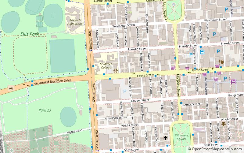
St Patrick's Church is a heritage-listed Roman Catholic church on Grote Street, Adelaide, South Australia. Opened in 1914, St Patrick's was built as a replacement for the original St. Patrick's church that is considered the first Catholic Church in Adelaide. Today the Church is used for services in languages other than English, including Portuguese and Croatian. ()
Architectural style: Neo-BaroqueCoordinates: 34°55'45"S, 138°35'24"E
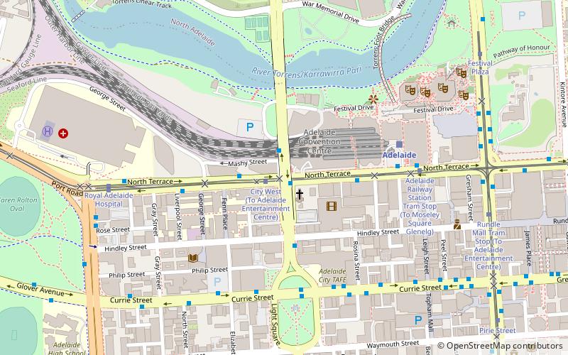
Getting there by public transportation
Public transportation stops near this location
- Bus
- Tram
- Train
 Bus
Bus
- Calculate route85 Franklin Street 9 min walk
- Calculate routeStop D1 Currie Street - North side 11 min walk
- Calculate routeStop W2 Currie Street - South side 11 min walk
- Calculate routeStop U2 Victoria Square - North West side 15 min walk
- Calculate routeRoyal Adelaide Hospital 13 min walk
- Calculate routeCity West 14 min walk
- Calculate routeVictoria Square /Tarndanyangga 14 min walk
- Calculate routePirie Street 16 min walk
- Calculate routeMile End 16 min walk
- Calculate routeAdelaide 18 min walk
- Calculate routeAdelaide Parklands Terminal 20 min walk
- Calculate routeAdelaide Showground 28 min walk
Day trips


Frequently Asked Questions (FAQ)
Which popular attractions are close to St Patrick's Church?
Nearby attractions include Wright Street, Adelaide (6 min walk), Grote Street, Adelaide (6 min walk), Gouger Street, Adelaide (7 min walk), Sturt Street, Adelaide (7 min walk).
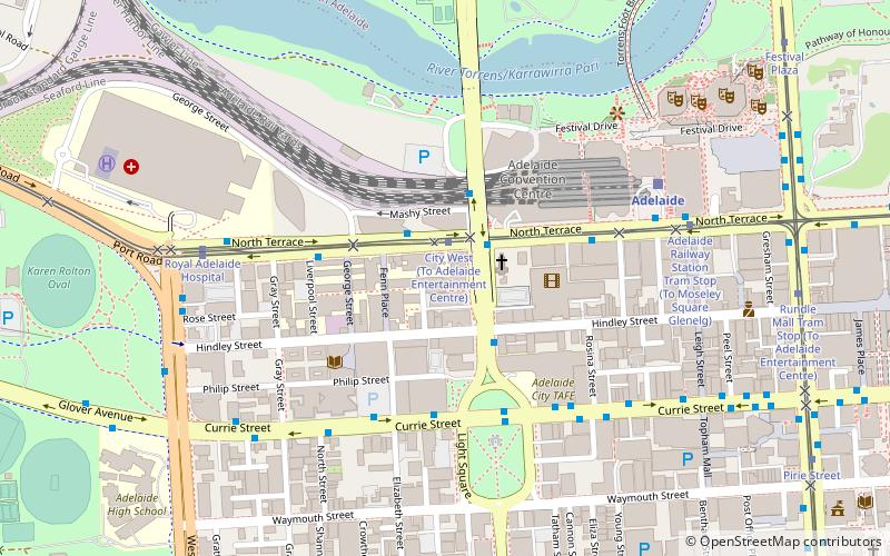
How to get to St Patrick's Church by public transport?
The nearest stations to St Patrick's Church:
Bus
Tram
Train
Bus
- 85 Franklin Street • Lines: Adelaide bus station => Albury r, Adelaide bus station => Bendigo, Albury railway station => Adelai, Bendigo railway station => Adela (9 min walk)
- Stop D1 Currie Street - North side • Lines: 830F (11 min walk)
Tram
- Royal Adelaide Hospital (13 min walk)
- City West (14 min walk)
Train
- Mile End (16 min walk)
- Adelaide (18 min walk)