Station Pier, Melbourne
Map

Map

Facts and practical information
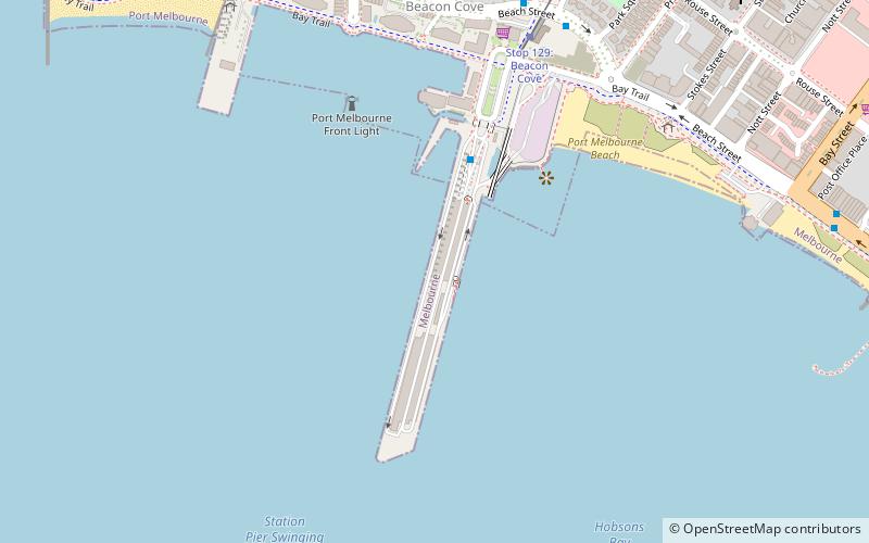
Station Pier is a historic Australian pier on Port Phillip, in Port Melbourne, Victoria. Opened in 1854, the pier is Melbourne's primary passenger terminal, servicing interstate ferries and cruise ships, and is listed on the Victorian Heritage Register. ()
Coordinates: 37°50'40"S, 144°55'52"E
Address
Port Phillip (Port Melbourne)Melbourne
ContactAdd
Social media
Add
Day trips
Station Pier – popular in the area (distance from the attraction)
Nearby attractions include: Montague Street Bridge, Port Melbourne, Sandridge Trail, Port Melbourne Town Hall.
Frequently Asked Questions (FAQ)
Which popular attractions are close to Station Pier?
Nearby attractions include SS Anderson Reserve, Melbourne (21 min walk), Port Melbourne, Melbourne (24 min walk).
How to get to Station Pier by public transport?
The nearest stations to Station Pier:
Bus
Tram
Bus
- Station Pier • Lines: 109 (4 min walk)
- Port Melbourne Station • Lines: 236 (8 min walk)
Tram
- Stop 129: Beacon Cove • Lines: 109, 109d (7 min walk)
- Stop 128: Graham Street • Lines: 109, 109d (16 min walk)

 Melbourne Trams
 Victoria Trains


