Sandridge Trail, Melbourne

Gallery (1)
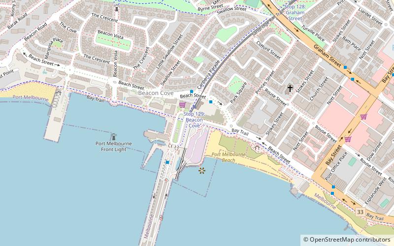
Map
Map
Facts and practical information
The Sandridge Trail is a shared-use path for cyclists and pedestrians located in the inner southern suburb of Port Melbourne in Melbourne, Victoria, Australia. ()
Length: 9843 ftCoordinates: 37°50'29"S, 144°55'59"E
Address
Port Phillip (Port Melbourne)Melbourne
ContactAdd
Social media
Add
Getting there by public transportation
Public transportation stops near this location
- Bus
- Tram
 Bus
Bus
- Calculate routeStop 129: Beacon Cove 1 min walk
- Calculate routeStop 128: Graham Street 10 min walk
- Calculate routeStop 127: North Port 21 min walk
- Calculate routeStop 32: Beaconsfield Parade 25 min walk
- Calculate routePort Melbourne Station 2 min walk
- Calculate routeStation Pier 3 min walk
- Calculate routeDow Street 10 min walk
- Calculate routeBay Street 10 min walk
Maps Melbourne TramsMaps
 Victoria Trains
Melbourne TramsMapsVictoria TrainsDay trips


Frequently Asked Questions (FAQ)
Which popular attractions are close to Sandridge Trail?
Nearby attractions include Station Pier, Melbourne (7 min walk), SS Anderson Reserve, Melbourne (16 min walk), Port Melbourne Town Hall, Melbourne (20 min walk), Port Melbourne, Melbourne (21 min walk).
How to get to Sandridge Trail by public transport?
The nearest stations to Sandridge Trail:
Tram
Bus
Tram
- Stop 129: Beacon Cove • Lines: 109, 109d (1 min walk)
- Stop 128: Graham Street • Lines: 109, 109d (10 min walk)
Bus
- Port Melbourne Station • Lines: 236 (2 min walk)
- Station Pier • Lines: 109 (3 min walk)