Rouse Hill House, Sydney
Map
Facts and practical information
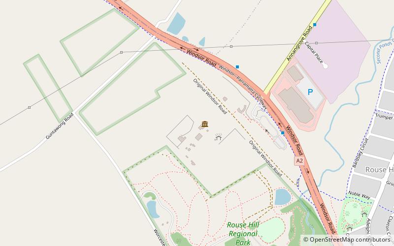
Rouse Hill Estate is a heritage-listed homestead and estate off Windsor Road, Rouse Hill, City of Blacktown, New South Wales, Australia. Rouse Hill House and farm was the family home of Richard Rouse, the Colonial Superintendent of Public Works and Convicts at Parramatta. ()
Completed: 1819 (207 years ago)Coordinates: 33°40'33"S, 150°54'29"E
Getting there by public transportation
Public transportation stops near this location
- Metro
- Bus
 Metro
Metro
- Calculate routePanmure St 18 min walk
- Calculate routeAdelphi Street and Mile End Road 19 min walk
- Calculate routeRouse Hill Drive 34 min walk
- Calculate routeTallawong 28 min walk
- Calculate routeRouse Hill 37 min walk
Maps Sydney TrainsMaps
 Sydney Light RailMaps
 Sydney Ferries
Sydney TrainsMapsSydney Light RailMapsSydney FerriesDay trips


Frequently Asked Questions (FAQ)
How to get to Rouse Hill House by public transport?
The nearest stations to Rouse Hill House:
Bus
Metro
Bus
- Panmure St • Lines: 633, T75 (18 min walk)
- Adelphi Street and Mile End Road • Lines: 633, T75 (19 min walk)
Metro
- Tallawong • Lines: Sydney Metro Northwest (28 min walk)
- Rouse Hill • Lines: Sydney Metro Northwest (37 min walk)