Newcastle Street Circuit, Newcastle
Map
Facts and practical information
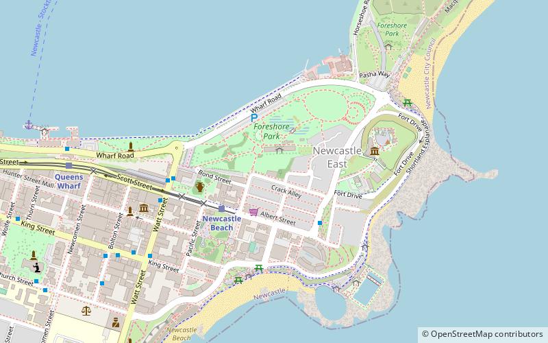
The Newcastle Street Circuit is a temporary street circuit around the east end of Newcastle, New South Wales, Australia. The circuit hosts the Newcastle 500, the final round of the Supercars Championship. The 12-turn, 2.641 km circuit takes in Newcastle Beach and the foreshore around Nobbys Beach Reserve. ()
Coordinates: 32°55'35"S, 151°47'17"E
Address
Newcastle
ContactAdd
Social media
Add
Getting there by public transportation
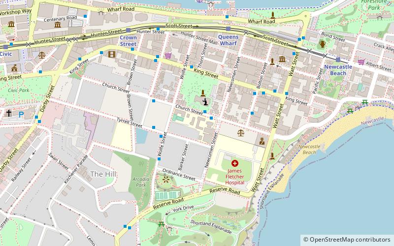
Public transportation stops near this location
- Bus
- Light rail
- Ferry
 Bus
Bus
- Calculate routeNewcastle Beach 3 min walk
- Calculate routeQueens Wharf 10 min walk
- Calculate routeCrown Street 16 min walk
- Calculate routeCivic 24 min walk
- Calculate routeCustoms House, Watt Street 5 min walk
- Calculate routeWatt St opp Customs House 5 min walk
- Calculate routeKing St at Bolton St 9 min walk
- Calculate routeNewcastle Wharf 12 min walk
Day trips


Frequently Asked Questions (FAQ)
Which popular attractions are close to Newcastle Street Circuit?
Nearby attractions include Convict Lumber Yard, Newcastle (4 min walk), Fort Scratchley, Newcastle (5 min walk), Nobbys Lighthouse, Newcastle (6 min walk), T & G Mutual Life Assurance Building, Newcastle (6 min walk).
How to get to Newcastle Street Circuit by public transport?
The nearest stations to Newcastle Street Circuit:
Light rail
Bus
Ferry
Light rail
- Newcastle Beach • Lines: L (3 min walk)
- Queens Wharf • Lines: L (10 min walk)
Bus
- Customs House, Watt Street • Lines: 11, 13, 14 (5 min walk)
- Watt St opp Customs House • Lines: 11, 13, 14 (5 min walk)
Ferry
- Newcastle Wharf • Lines: Newcastle - Stockton Ferry (12 min walk)