Nobbys Head Light, Newcastle

Facts and practical information
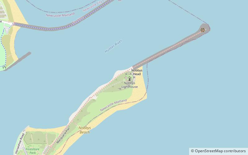
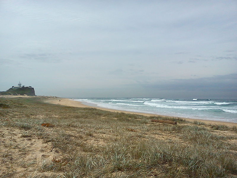
Nobbys Head Light stands as an iconic beacon in the coastal city of Newcastle, Australia. This historical lighthouse, operational since 1858, is perched atop a picturesque headland and has become one of the city's most recognizable landmarks. With its stark white tower piercing the blue Australian sky, the lighthouse serves as a navigational guide for vessels entering the Hunter River.
Constructed as a key feature for maritime safety, Nobbys Head Light has a storied past, with its operation intimately tied to the development and growth of Newcastle's port. The lighthouse's strategic position has ensured safe passage for countless ships against the treacherous swells and hidden dangers lurking off the Newcastle coast.
Measuring at a modest height of approximately 27.5 meters, the lighthouse may not tower over the landscape, but its historical significance and the panoramic views it offers of the Pacific Ocean make it a must-visit destination. The structure, with its classic cylindrical design, is simplistic yet striking, embodying the no-nonsense approach of functional maritime architecture.
Accessible to the public, Nobbys Head Light is not only a bastion for maritime navigation but also a popular spot for locals and tourists alike. Visitors can stroll along the breakwater connecting the lighthouse to the mainland, enjoying the sea breeze and the occasional sighting of dolphins and whales. The surrounding area, with its rich biodiversity, is a haven for birdwatchers and nature enthusiasts.
The lighthouse operates continuously, with its light casting over the sea as a steadfast guardian. Although it is automated today, the legacy of the lighthouse keepers who once meticulously maintained its flame endures in the stories and history that imbue the site with a sense of living heritage.
- Bus
- Light rail
- Ferry
 Bus
Bus
- Calculate routeNewcastle Beach 24 min walk
- Calculate routeQueens Wharf 28 min walk
- Calculate routeCustoms House, Watt Street 25 min walk
- Calculate routeWatt St opp Customs House 25 min walk
- Calculate routeKing St at Bolton St 29 min walk
- Calculate routeNewcastle Wharf 29 min walk


Frequently Asked Questions (FAQ)
Which popular attractions are close to Nobbys Head Light?
How to get to Nobbys Head Light by public transport?
Light rail
- Newcastle Beach • Lines: L (24 min walk)
- Queens Wharf • Lines: L (28 min walk)
Bus
- Customs House, Watt Street • Lines: 11, 13, 14 (25 min walk)
- Watt St opp Customs House • Lines: 11, 13, 14 (25 min walk)
Ferry
- Newcastle Wharf • Lines: Newcastle - Stockton Ferry (29 min walk)