Dawes Point Battery, Sydney
Facts and practical information
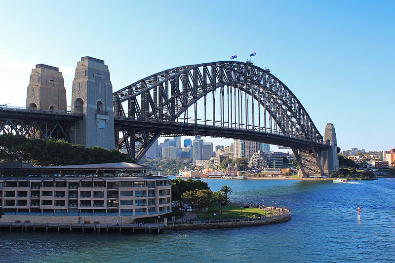
The Dawes Point Battery remains is a heritage-listed former artillery fortification and now visitor attraction located adjacent to the southern pylon of the Sydney Harbour Bridge at Hickson Road in inner city Sydney, on the boundary between Dawes Point and The Rocks in the City of Sydney local government area of New South Wales, Australia. It was built and modified from 1791 to 1925 by Lieutenant William Dawes, Robert Ross, Francis Greenway, and George Barney. The property is owned by Property NSW, an agency of the Government of New South Wales. It was added to the New South Wales State Heritage Register on 10 May 2002. ()
Central Business District (Dawes Point)Sydney
- Bus
- Light rail
- Train
- Ferry
 Bus
Bus
- Calculate routeCircular Quay Wharf 5 10 min walk
- Calculate routeMilsons Point Wharf 10 min walk
- Calculate routeCircular Quay Wharf 4 11 min walk
- Calculate routeCircular Quay Wharf 3 11 min walk
- Calculate routeCircular Quay 12 min walk
- Calculate routeMilsons Point 17 min walk
- Calculate routeWynyard 21 min walk
- Calculate routeMartin Place 23 min walk
- Calculate routeCircular Quay 12 min walk
- Calculate routeBridge Street 17 min walk
- Calculate routeWynyard 21 min walk
- Calculate routeQvb 30 min walk
- Calculate routeStand A, Circular Quay, Alfred Street 13 min walk
- Calculate routeCircular Quay 13 min walk
- Calculate routeStand C, Phillip Street 15 min walk
- Calculate routeLang Park 17 min walk
 Sydney TrainsMaps
 Sydney Light RailMaps
 Sydney Ferries
Dawes Point Battery – popular in the area (distance from the attraction)
Nearby attractions include: Sydney Harbour Bridge, Overseas Passenger Terminal, Argyle Stores, Glenmore Hotel.


Frequently Asked Questions (FAQ)
Which popular attractions are close to Dawes Point Battery?
How to get to Dawes Point Battery by public transport?
Ferry
- Circular Quay Wharf 5 • Lines: F3, F4 (10 min walk)
- Milsons Point Wharf • Lines: F3, F4 (10 min walk)
Train
- Circular Quay (12 min walk)
- Milsons Point (17 min walk)
Light rail
- Circular Quay • Lines: L2, L3 (12 min walk)
- Bridge Street • Lines: L2, L3 (17 min walk)
Bus
- Stand A, Circular Quay, Alfred Street • Lines: 302, 303, 326 (13 min walk)
- Circular Quay • Lines: 302, 303 (13 min walk)