Southpoint Shopping Centre, Sydney

Gallery (1)
Map
Map
Facts and practical information
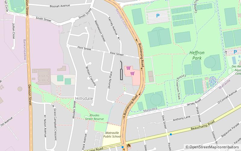
Southpoint Shopping Centre is a shopping centre in the suburb of Hillsdale in the Eastern Suburbs of Sydney. ()
Coordinates: 33°57'6"S, 151°13'48"E
Address
238-262 Bunnerong RdEastern Suburbs (Hillsdale)Sydney 2036
Contact
+61 2 9311 3301
Social media
Add
Getting there by public transportation
Public transportation stops near this location
- Bus
 Bus
Bus
- Calculate routeWestfield Eastgardens Upper Level 13 min walk
Maps Sydney TrainsMaps
 Sydney Light RailMaps
 Sydney Ferries
Sydney TrainsMapsSydney Light RailMapsSydney FerriesDay trips


Frequently Asked Questions (FAQ)
When is Southpoint Shopping Centre open?
Southpoint Shopping Centre is open:
- Monday 9 am - 5:30 pm
- Tuesday 9 am - 5:30 pm
- Wednesday 9 am - 5:30 pm
- Thursday 9 am - 9 pm
- Friday 9 am - 5:30 pm
- Saturday 9 am - 5 pm
- Sunday 10 am - 4 pm
How to get to Southpoint Shopping Centre by public transport?
The nearest stations to Southpoint Shopping Centre:
Bus
Bus
- Westfield Eastgardens Upper Level • Lines: 301, 302 (13 min walk)