Priceline Stadium, Adelaide
Map
Facts and practical information
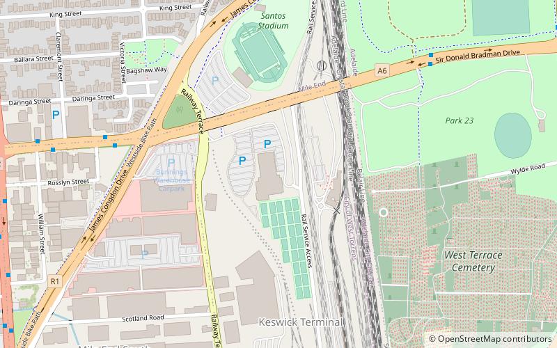
Netball SA Stadium is an Australia netball stadium based in Mile End South, Adelaide. Due to sponsorship and naming rights arrangements, it has also been known as ETSA Park and Priceline Stadium. The stadium is owned by the Government of South Australia who in turn lease it to Netball South Australia. It is the main home venue for Adelaide Thunderbirds of Suncorp Super Netball and Southern Force of the Australian Netball League. It is also the main host venue for the Netball South Australia Premier League. It also serves as the headquarters for Netball South Australia. ()
Opened: 14 March 2001 (24 years ago)Capacity: 3200Coordinates: 34°55'57"S, 138°34'44"E
Address
Keswick TerminalAdelaide
ContactAdd
Social media
Add
Getting there by public transportation
Public transportation stops near this location
- Bus
- Tram
- Train
 Bus
Bus
- Calculate routeAdelaide Parklands Terminal 10 min walk
- Calculate routeMile End 14 min walk
- Calculate routeAdelaide Showground 22 min walk
- Calculate routeAdelaide 33 min walk
- Calculate routeRoyal Adelaide Hospital 23 min walk
- Calculate routeThebarton 27 min walk
- Calculate routeCity West 28 min walk
- Calculate routeVictoria Square /Tarndanyangga 31 min walk
- Calculate route85 Franklin Street 26 min walk
- Calculate routeStop D1 Currie Street - North side 27 min walk
- Calculate routeStop W2 Currie Street - South side 28 min walk
- Calculate routeStop U2 Victoria Square - North West side 31 min walk
Day trips


Frequently Asked Questions (FAQ)
Which popular attractions are close to Priceline Stadium?
Nearby attractions include West Terrace Cemetery, Adelaide (10 min walk), Wright Street, Adelaide (14 min walk), Sturt Street, Adelaide (16 min walk), St Patrick's Church, Adelaide (17 min walk).
How to get to Priceline Stadium by public transport?
The nearest stations to Priceline Stadium:
Train
Tram
Bus
Train
- Adelaide Parklands Terminal (10 min walk)
- Mile End (14 min walk)
Tram
- Royal Adelaide Hospital (23 min walk)
- Thebarton (27 min walk)
Bus
- 85 Franklin Street • Lines: Adelaide bus station => Albury r, Adelaide bus station => Bendigo, Albury railway station => Adelai, Bendigo railway station => Adela (26 min walk)
- Stop D1 Currie Street - North side • Lines: 830F (27 min walk)