White City Stadium, Sydney
Map
Facts and practical information
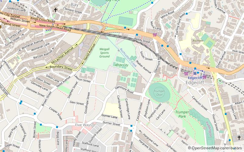
White City Stadium at the White City Tennis Club is a tennis venue in Rushcutters Bay, Sydney, Australia. The stadium was built in 1922 on the former site of Sydney's White City amusement park as a new venue for the New South Wales Championships. The venue served as host of the tournament until the Sydney Olympic Park Tennis Centre opened for the 2000 Summer Olympics. The Club was formed in 1947, and today has 16 grass courts, 6 synthetic grass courts, and 6 Rebound Ace hard courts. The Australian Tennis Museum was located at White City from its founding in 1983 until 2005 when it moved out to Sydney Olympic Park Tennis Centre. ()
Coordinates: 33°52'46"S, 151°13'52"E
Address
Eastern Suburbs (Darlinghurst)Sydney
ContactAdd
Social media
Add
Getting there by public transportation
Public transportation stops near this location
- Bus
- Light rail
- Train
- Ferry
 Bus
Bus
- Calculate routeEdgecliff 8 min walk
- Calculate routeKings Cross 16 min walk
- Calculate routeSt James 32 min walk
- Calculate routeBondi Junction 34 min walk
- Calculate routeEdgecliff Station, Stand K 8 min walk
- Calculate routeKellett Street 14 min walk
- Calculate routeOcean St At Trelawney St 14 min walk
- Calculate routeDomain Terminus 25 min walk
- Calculate routeDouble Bay Wharf 21 min walk
- Calculate routeDarling Point 27 min walk
- Calculate routeMoore Park 29 min walk
- Calculate routeSurry Hills 32 min walk
Maps Sydney TrainsMaps
 Sydney Light RailMaps
 Sydney Ferries
Sydney TrainsMapsSydney Light RailMapsSydney FerriesDay trips


Frequently Asked Questions (FAQ)
Which popular attractions are close to White City Stadium?
Nearby attractions include Trumper Park, Sydney (7 min walk), Five Ways, Sydney (7 min walk), Roslyn Oxley9 Gallery, Sydney (9 min walk), Bayswater Road, Sydney (11 min walk).
How to get to White City Stadium by public transport?
The nearest stations to White City Stadium:
Train
Bus
Ferry
Light rail
Train
- Edgecliff (8 min walk)
- Kings Cross (16 min walk)
Bus
- Edgecliff Station, Stand K • Lines: 200 (8 min walk)
- Kellett Street • Lines: 200 (14 min walk)
Ferry
- Double Bay Wharf • Lines: F7 (21 min walk)
- Darling Point • Lines: F7 (27 min walk)
Light rail
- Moore Park • Lines: L2, L3 (29 min walk)
- Surry Hills • Lines: L2, L3 (32 min walk)