Castlemaine Brewery, Newcastle
Map
Facts and practical information
The Castlemaine Brewery was an Australian brewery and brewing company established in 1857 by Edward Fitzgerald. He was joined in the business by his brother Nicholas Fitzgerald in 1859, after which the firm spread rapidly, opening breweries in Melbourne, Newcastle, Sydney and Brisbane, along with smaller breweries at Daylesford and Newbridge. The breweries, though all originating from the same brothers, were either established or later floated as separate companies with distinct histories thereafter, even though the brothers retained a stake in them. ()
Coordinates: 32°55'32"S, 151°45'29"E
Address
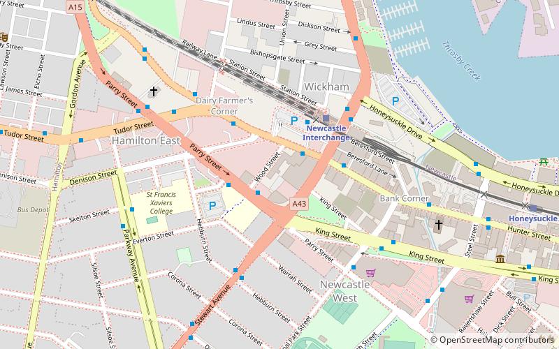
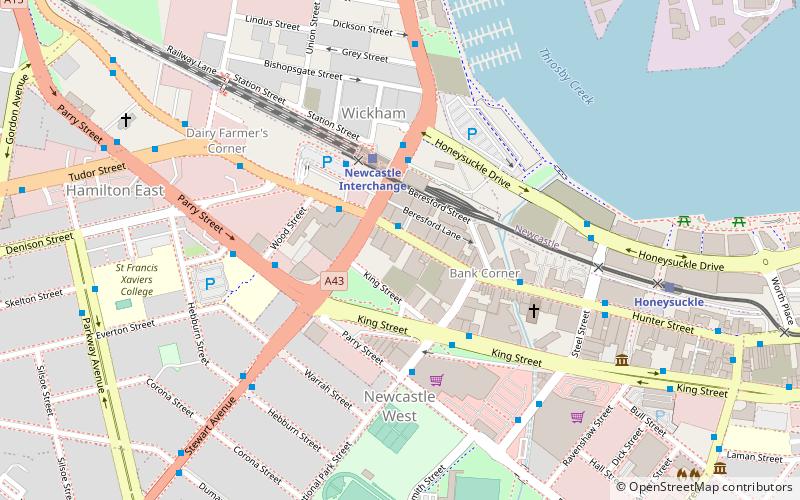
Newcastle
ContactAdd
Social media
Add
Getting there by public transportation
Public transportation stops near this location
- Bus
- Light rail
- Train
 Bus
Bus
- Calculate routeHunter St Opp Cooper St 2 min walk
- Calculate routeNewcastle Interchange, Stand C 3 min walk
- Calculate routeNewcastle Interchange 4 min walk
- Calculate routeHoneysuckle 12 min walk
- Calculate routeCivic 21 min walk
- Calculate routeCrown Street 29 min walk
- Calculate routeNewcastle Interchange 4 min walk
- Calculate routeHamilton 19 min walk
Day trips


Frequently Asked Questions (FAQ)
Which popular attractions are close to Castlemaine Brewery?
Nearby attractions include Pinnacle Apartments, Newcastle (3 min walk), Miss Porter's House, Newcastle (12 min walk), Civic, Newcastle (21 min walk), Newcastle City Hall, Newcastle (22 min walk).
How to get to Castlemaine Brewery by public transport?
The nearest stations to Castlemaine Brewery:
Bus
Light rail
Train
Bus
- Hunter St Opp Cooper St • Lines: 11, 12, 13, 26 (2 min walk)
- Newcastle Interchange, Stand C • Lines: 152 (3 min walk)
Light rail
- Newcastle Interchange • Lines: L (4 min walk)
- Honeysuckle • Lines: L (12 min walk)
Train
- Newcastle Interchange (4 min walk)
- Hamilton (19 min walk)