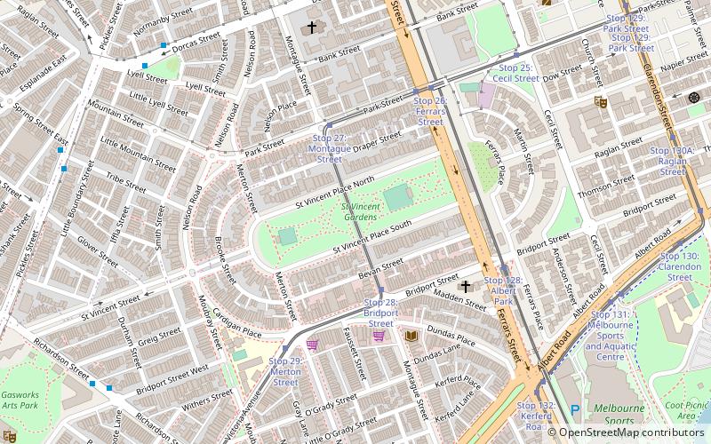
St Vincent Place, Melbourne
Map
Facts and practical information
St Vincent Place is a heritage precinct in Albert Park, Victoria, Australia. ()
Coordinates: 37°50'21"S, 144°57'18"E
Address
Port Phillip (Albert Park)Melbourne
ContactAdd
Social media
Add
Getting there by public transportation
Public transportation stops near this location
- Bus
- Tram
 Bus
Bus
- Calculate routeStop 28: Bridport Street 3 min walk
- Calculate routeStop 27: Montague Street 4 min walk
- Calculate routeIffla Street 9 min walk
- Calculate routeLyell Street 9 min walk
- Calculate routeAlbert Park Shops 10 min walk
- Calculate routeVictoria Ave/Richardson St 10 min walk
Maps Melbourne TramsMaps
 Victoria Trains
Melbourne TramsMapsVictoria TrainsDay trips


Frequently Asked Questions (FAQ)
Which popular attractions are close to St Vincent Place?
Nearby attractions include St Vincent Gardens, Melbourne (1 min walk), Melbourne/Inner south, Melbourne (11 min walk), South Melbourne Town Hall, Melbourne (11 min walk), The Butterfly Club, Melbourne (12 min walk).
How to get to St Vincent Place by public transport?
The nearest stations to St Vincent Place:
Tram
Bus
Tram
- Stop 28: Bridport Street • Lines: 1 (3 min walk)
- Stop 27: Montague Street • Lines: 1 (4 min walk)
Bus
- Iffla Street • Lines: 236 (9 min walk)
- Lyell Street • Lines: 236 (9 min walk)