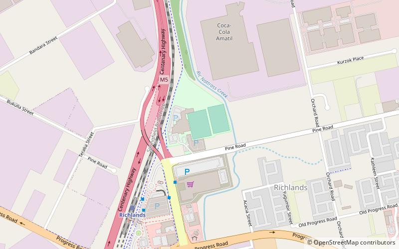
Lions Stadium, Brisbane
Map
Facts and practical information
Lions Stadium is a soccer stadium located in Brisbane, Queensland, Australia. It has lights for night matches and can seat up to 5000 people. ()
Coordinates: 27°35'33"S, 152°56'60"E
Address
RichlandsBrisbane
ContactAdd
Social media
Add
Getting there by public transportation
Public transportation stops near this location
- Bus
- Train
 Bus
Bus
- Calculate routeRichlands bus station, stop B 7 min walk
- Calculate routeRichlands bus station, stop A 7 min walk
- Calculate routeGarden Road at Government Road 14 min walk
- Calculate routeForest Lake Boulevard at Forest Lake stop E 24 min walk
- Calculate routeRichlands 8 min walk
Day trips


Frequently Asked Questions (FAQ)
How to get to Lions Stadium by public transport?
The nearest stations to Lions Stadium:
Bus
Train
Bus
- Richlands bus station, stop B • Lines: 460, N100 (7 min walk)
- Richlands bus station, stop A • Lines: 460 (7 min walk)
Train
- Richlands (8 min walk)