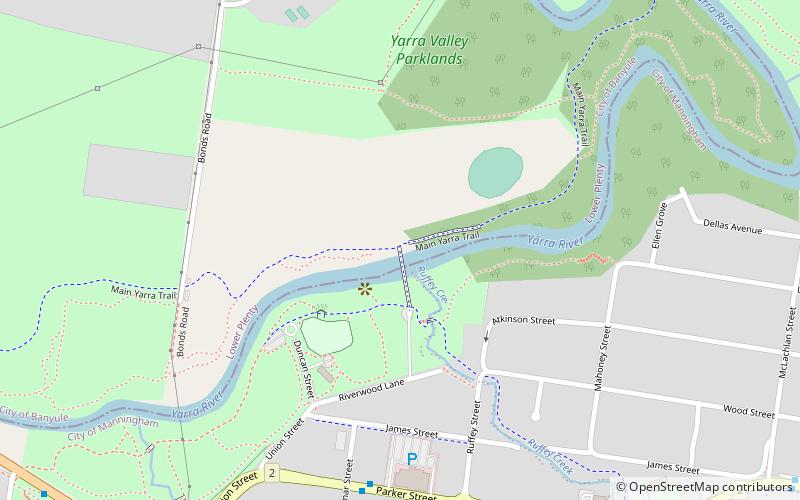
Ruffey Creek Trail, Melbourne
Map
Facts and practical information
Coordinates: 37°45'9"S, 145°7'3"E
Address
Banyule (Lower Plenty)Melbourne
ContactAdd
Social media
Add
Getting there by public transportation
Public transportation stops near this location
- Bus
 Bus
Bus
- Calculate routeFoote Street/High Street 11 min walk
- Calculate routeFoote Street/Thompsons Road 12 min walk
- Calculate routeRosemary Street/High Street 13 min walk
- Calculate routeMacRobertson Street/High Street 15 min walk
Maps Melbourne TramsMaps
 Victoria Trains
Melbourne TramsMapsVictoria TrainsDay trips


Frequently Asked Questions (FAQ)
How to get to Ruffey Creek Trail by public transport?
The nearest stations to Ruffey Creek Trail:
Bus
Bus
- Foote Street/High Street • Lines: 281 (11 min walk)
- Foote Street/Thompsons Road • Lines: 905 (12 min walk)