Hochplattig
#541 among destinations in Austria


Facts and practical information
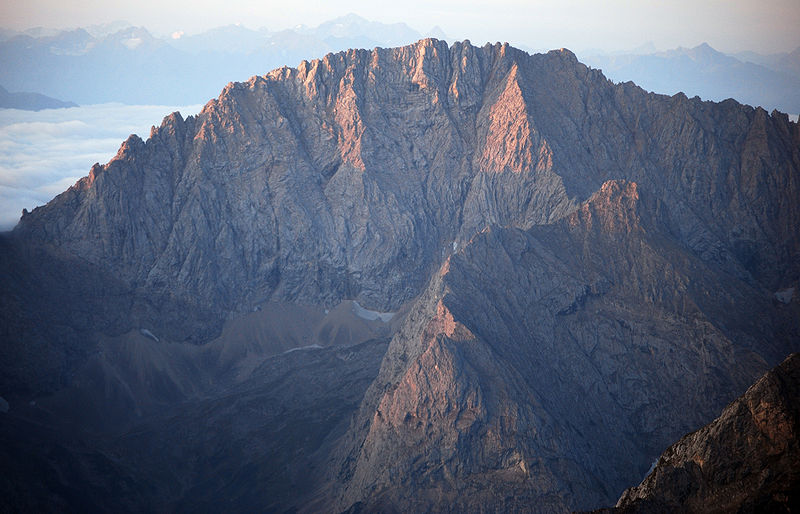
The Hochplattig is a mountain, 2,768 m high, and the highest summit in the Mieming Chain, a mountain range in the Northern Limestone Alps in the state of Tyrol, Austria. ()
TyrolAustria
Hochplattig – popular in the area (distance from the attraction)
Nearby attractions include: Wiener-Neustädter Hut, Seebensee, Schneefernerkopf, Daniel Mountain.
 Alpine hut, Hiking
Wiener-Neustädter Hut
126 min walk • Nestled high in the Austrian Alps, the Wiener-Neustädter Hut is a haven for mountaineers and hikers seeking respite amidst the rugged beauty of the mountains. This alpine hut, strategically perched at an altitude of 2,208 meters, offers breathtaking views of the...
 Nature, Natural attraction, Lake
Seebensee
69 min walk • Nestled in the heart of the Tyrolean Alps, Seebensee is an alpine jewel that captivates visitors with its tranquil beauty and pristine waters. This stunning lake, located in Austria, is a testament to the breathtaking natural landscapes that the country has to offer.
 Nature, Natural attraction, Mountain
Schneefernerkopf
102 min walk • Schneefernerkopf, a prominent peak nestled in the Eastern Alps, stands as a majestic testament to Austria's alpine grandeur. At an elevation of 2,962 meters, it is one of the country's highest summits, offering breathtaking views and challenging terrain for...
 Nature, Natural attraction, Mountain
Daniel Mountain
191 min walk • The Daniel is a mountain in the Austrian state of Tyrol, and the highest peak in the Ammergau Alps, a range within the Northern Limestone Alps. Located near the villages of Ehrwald and Lermoos, it is a popular mountain with hikers. Its North Face is around 200 metres high and its South Face has a more schrofen-like character.
 Valley
Inntal, Stams
127 min walk • The Inntal is the valley containing the Inn river in Switzerland, Austria and Germany. The valley has a total length of 517 km and the biggest city located in Inntal is Innsbruck.
 Nature, Natural attraction, Mountain
Hohe Munde
100 min walk • The Hohe Munde is a 2,662-metre-high mountain at the eastern end of the Mieming Chain in the Austrian state of Tyrol. It has two peaks: the west top and the east top or Mundekopf.
 Natural attraction, Nature, Mountain
Hochwanner
110 min walk • At 2,744 metres, the Hochwanner is the second highest mountain in Germany after the Zugspitze. In addition the Hochwanner is the highest peak on the main ridge of the Wetterstein running from Gatterl to the Upper Wettersteinspitze above Mittenwald in an east–west direction.
 47°24'5"N • 10°55'6"E
Familienbad und Sauna Ehrwald, Ehrwald
120 min walk • Watersports, Water park, Swimming
 Nature, Natural attraction, Mountain
Wankspitze
66 min walk • Wankspitze is a summit of the Mieming Range in the Austrian state of Tyrol. It separates the Griessspitzen to the north from the Mieming Plateau to the south.
 Area
AreaPfaffenhofen, Telfs
145 min walk • Pfaffenhofen is a municipality in the district of Innsbruck-Land in the Austrian state of Tyrol located 22 km west of Innsbruck and 1.7 km south of Telfs. The village was mentioned in documents in 1197 for the first time.
 Nature, Natural attraction, Mountain
Wetterspitzen
86 min walk • The Wetterspitzen are three of the rocky peaks on a mountain ridge in the Wetterstein mountains in the central part of the Eastern Alps in Germany.
